Trimble R12i GNSS System
New Trimble R12i GNSS Receiver System, 1-year warranty.
Condition: New

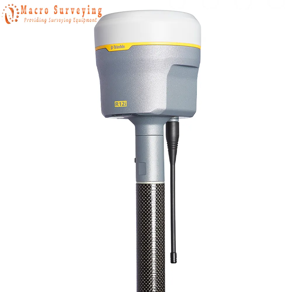

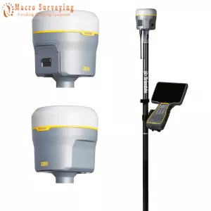
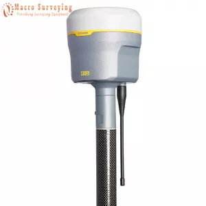
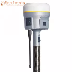
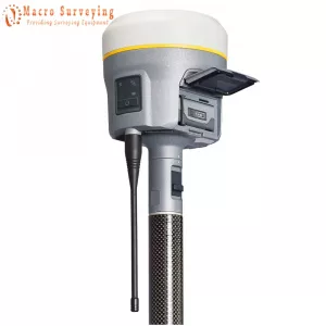
Trimble R12i GNSS Receiver for sale with Trimble ProPoint GNSS technology and new Trimble TIP tilt compensation, 8 mm H / 15 mm V RTK Precision, 672 GNSS channels, 2 cm H / 5 cm V Corrections, UHF Radio Wideband UHF radio. The Trimble R12i delivers unmatched GNSS performance, speed and accuracy to boost your productivity like never before. With improved performance in challenging GNSS conditions and robust IMU-based tilt compensation that lets you forget about leveling the pole, you'll get more done faster than you thought possible.
GNSS TECHNOLOGY
Trimble ProPoint: Superior performance and productivity in challenging GNSS environments such as near and among trees and buildings.
TILT COMPENSATION
Trimble TIP: Accurately stake out and measure points quickly and in more places without leveling the survey pole.
CORRECTION SERVICES
Trimble CenterPoint RTX: Obtain RTK level accuracy worldwide without the need for a base station or VRS network with real-time corrections via satellite or internet.
- Always on. Always on point: Satellite-delivered to reduce workflow complexity and complement your traditional RTK solutions, Trimble® CenterPoint® RTX correction provides centimeter-level accuracy in real time and enables untethered surveying—the freedom to work anywhere. And anytime.
- Freedom to work anywhere: Obtain reliable and repeatable results with the same RTK-quality performance.
CONTINUOUS PRECISION
Trimble xFill: Reduce downtime in the field with continuous RTK and VRS coverage during correction outages from radio and cellular black spots.
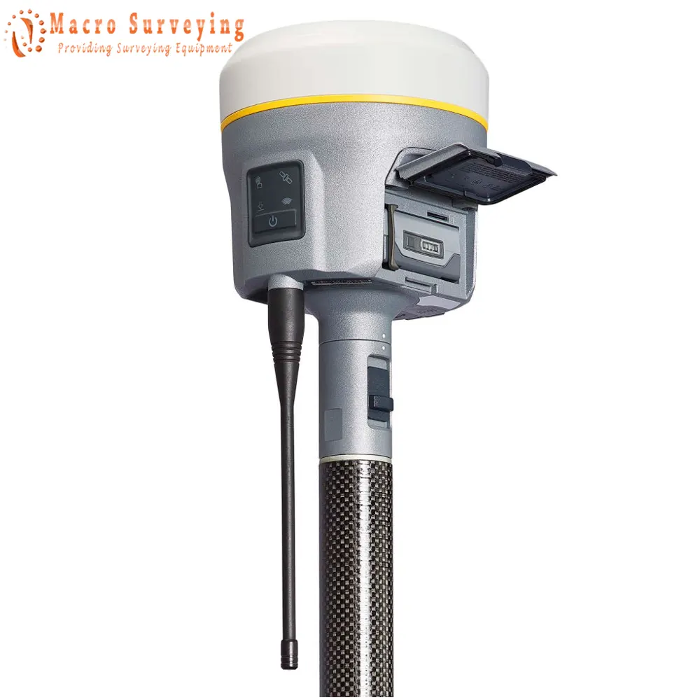
TRIMBLE R12i Key Features:
- Trimble® Inertial Platform™ (TIP) technology. Calibration-free and magnetically immune IMU-based tilt compensation for topo measurements and stakeout.
- Trimble ProPoint™ GNSS positioning engine. Engineered for improved accuracy and productivity in challenging GNSS conditions.
- 672-channel solution with Trimble 360 satellite tracking technology
- CenterPoint® RTX correction service delivers fast, RTK level accuracy worldwide via satellite/IP
- Trimble xFill® correction outage technology
- Optimized for Trimble Access™ field software
- Android™ and iOS platform support
- Cellular, Bluetooth®, Wi-Fi data connectivity
- Military-spec rugged design and IP-67 rating
- Ergonomic form factor
- All day battery with built-in status indicator
- 6 GB internal memory
| PERFORMANCE SPECIFICATIONS | |
| GNSS MEASUREMENTS | |
|
|
| POSITIONING PERFORMANCE | |
| STATIC GNSS SURVEYING | |
| High-Precision Static |
|
| Static and Fast Static |
|
| REAL TIME KINEMATIC SURVEYING | |
| Single Baseline <30 km |
|
| Network RTK |
|
| RTK start-up time for specified precisions | 2 to 8 seconds |
| TRIMBLE INERTIAL PLATFORM (TIP) TECHNOLOGY | |
| TIP Compensated Surveying | Horizontal: RTK + 5 mm + 0.4 mm/° tilt (up to 30°) RMS |
| IMU Integrity | Monitor Bias monitoring: Temperature, age and shock |
| TRIMBLE RTX CORRECTION SERVICES | |
| CenterPoint RTX |
|
| TRIMBLE xFILL | |
| Horizontal | RTK + 10 mm/minute RMS |
| Vertical | RTK + 20 mm/minute RMS |
| TRIMBLE xFILL PREMIUM | |
| Horizontal | 3 cm RMS |
| Vertical | 7 cm RMS |
| CODE DIFFERENTIAL GNSS POSITIONING | |
| Horizontal | 0.25 m + 1 ppm RMS |
| Vertical | 0.50 m + 1 ppm RMS |
| SBAS | typically <5 m 3DRMS |
| HARDWARE | |
| ELECTRICAL | |
|
|
| Operating times on internal battery |
|
| PHYSICAL | |
| Dimensions (W×H) | 11.9 cm x 13.6 cm (4.6 in x 5.4 in) |
| Weight |
|
| Temperature |
|
| Humidity | 100%, condensing |
| Ingress protection | IP67 dustproof, protected from temporary immersion to depth of 1 m (3.28 ft) |
| Shock and vibration |
|
| COMMUNICATIONS AND DATA STORAGE | |
| Serial | 3-wire serial (7-pin Lemo) |
| USB v2.0 | Supports data download and high speed communications |
| Radio modem | Fully Integrated, sealed 450 MHz wide band receiver/transmitter with frequency range of 403 MHz to 473 MHz, support of Trimble, Pacific Crest, and SATEL radio protocols:
|
| Cellular | Integrated, 3.5 G modem, HSDPA 7.2 Mbps (download), GPRS multi-slot class 12, EDGE multi-slot class 12, Penta-band UMTS/HSDPA (WCDMA/FDD) 800/850/900/1900/2100 MHz, Quad-band EGSM 850/900/1800/1900 MHz, GSM CSD, 3GPP LTE |
| Bluetooth | Bluetooth Version 4.1 |
| Wi-Fi | 802.11 b,g, access point and client mode, WPA/WPA2/WEP64/WEP128 encryption |
| I/O ports | Serial, USB, TCP/IP, IBSS/NTRIP, Bluetooth |
| Data storage | 6 GB internal memory |
| Data format |
|
| WEBUI | |
|
|
| SUPPORTED CONTROLLERS & FIELD SOFTWARE | |
|
|
- Challenging GNSS environments are locations where the receiver has sufficient satellite availability to achieve minimum accuracy requirements, but where the signal may be partly obstructed by and/or reflected off of trees, buildings, and other objects. Actual results may vary based on user’s geographic location and atmospheric activity, scintillation levels, GNSS constellation health and availability, and level of multipath and signal occlusion.
- The current capability in the receivers is based on publicly available information. As such, Trimble cannot guarantee that these receivers will be fully compatible with a future generation of Galileo satellites or signals.
- Precision and reliability may be subject to anomalies due to multipath, obstructions, satellite geometry, and atmospheric conditions. The specifications stated recommend the use of stable mounts in an open sky view, EMI and multipath clean environment, optimal GNSS constellation configurations, along with the use of survey practices that are generally accepted for performing the highest-order surveys for the applicable application including occupation times appropriate for baseline length. Baselines longer than 30 km require precise ephemeris and occupations up to 24 hours may be required to achieve the high precision static specification.
- Network RTK PPM values are referenced to the closest physical base station.
- May be affected by atmospheric conditions, signal multipath, obstructions and satellite geometry. Initialization reliability is continuously monitored to ensure highest quality.
- TIP references the overall positioning error estimate at the tip of the surveying pole throughout the tilt compensation range. RTK refers to the estimated horizontal precision of the underlying GNSS position, which is dependent on factors that affect GNSS solution quality. The 5 mm constant error component accounts for residual misalignment between the vertical axes of the receiver and the built-in Inertial Measurement Unit (IMU) after factory calibration, assuming the receiver is mounted on a standard 2 m carbon fiber range pole which is properly calibrated and free from physical defects. The tilt-dependent error component is a function of the quality of the computed tilt azimuth, which is assumed here to be aligned using optimal GNSS conditions.
- RMS performance based on repeatable in field measurements. Achievable accuracy and initialization time may vary based on type and capability of receiver and antenna, user’s geographic location and atmospheric activity, scintillation levels, GNSS constellation health and availability and level of multipath including obstructions such as large trees and buildings.
- Accuracies are dependent on GNSS satellite availability. xFill positioning without an xFill Premium subscription ends after 5 minutes of radio downtime. xFill Premium will continue beyond 5 minutes providing the solution has converged, with typical precisions not exceeding 3 cm horizontal, 7 cm vertical. xFill is not available in all regions, check with your local sales representative for more information.
- RTK refers to the last reported precision before the correction source was lost and xFill started.
- Depends on SBAS system performance.
- Receiver will operate normally to -40 °C, internal batteries are rated from -20 °C to +60 °C (ambient +50 °C).
- Tracking GPS, GLONASS and SBAS satellites.
- Varies with temperature and wireless data rate. When using a receiver and internal radio in the transmit mode, it is recommended that an external 6 Ah or higher battery is used.
- Varies with terrain and operating conditions.
- Due to local regulations, the integrated cellular modem cannot be enabled in China, Taiwan, or Brazil. A Trimble controller integrated cellular modem or external cellular modem can be used to obtain GNSS corrections via an IP (Internet Protocol) connection.
- Bluetooth type approvals are country specific.
TRIMBLE INTEGRATED GNSS SYSTEMS COMPARATION
| Trimble R780 | Trimble R12 | Trimble R12i | |
| Max. Precision | 8 mm H/15 mm V | 8 mm H/15 mm V | 8 mm H/15 mm V |
| Channels | 336 | 672 | 672 |
| Antenna | Integrated | Integrated | Integrated |
| UHF Radio | Receive & Transmit | Receive & Transmit | Receive & Transmit |
| RTK Compatible |  |
|
|
| xFill | |
|
|
| Memory | 9 GB | 6 GB | 6 GB |
| Cellular | External | |
|
| Satellites | GPS, GLONASS, Galileo, BeiDou, NavIC, QZSS, SBAS | GPS, GLONASS, Galileo, BeiDou, NavIC, QZSS, SBAS | GPS, GLONASS, Galileo, BeiDou, NavIC, QZSS, SBAS |
| Additional Features | ProPoint, TIP Tilt Compensation | ProPoint | ProPoint, TIP Tilt Compensation |