Trimble VX Spatial DR300+ 1 Robotic Total Station
Up for sale used Trimble VX DR300+ 1 Robotic Total Station Spatial 3D Scanner with Trimble Access. Has been fully checked, calibrated, and cleaned by authorized Trimble service
Condition: Used
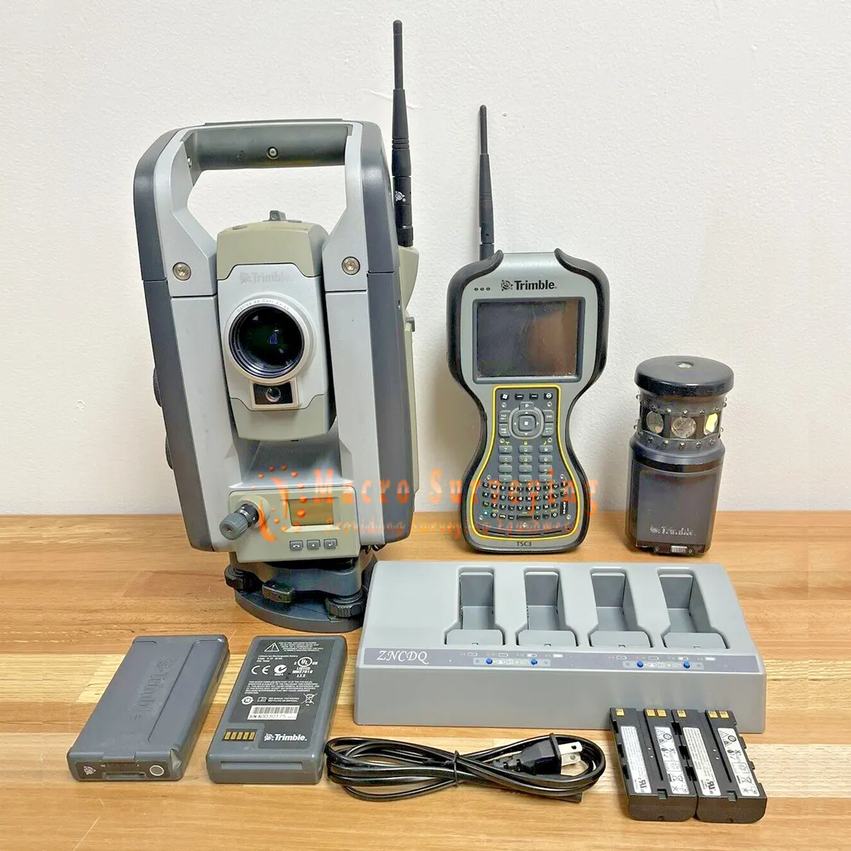
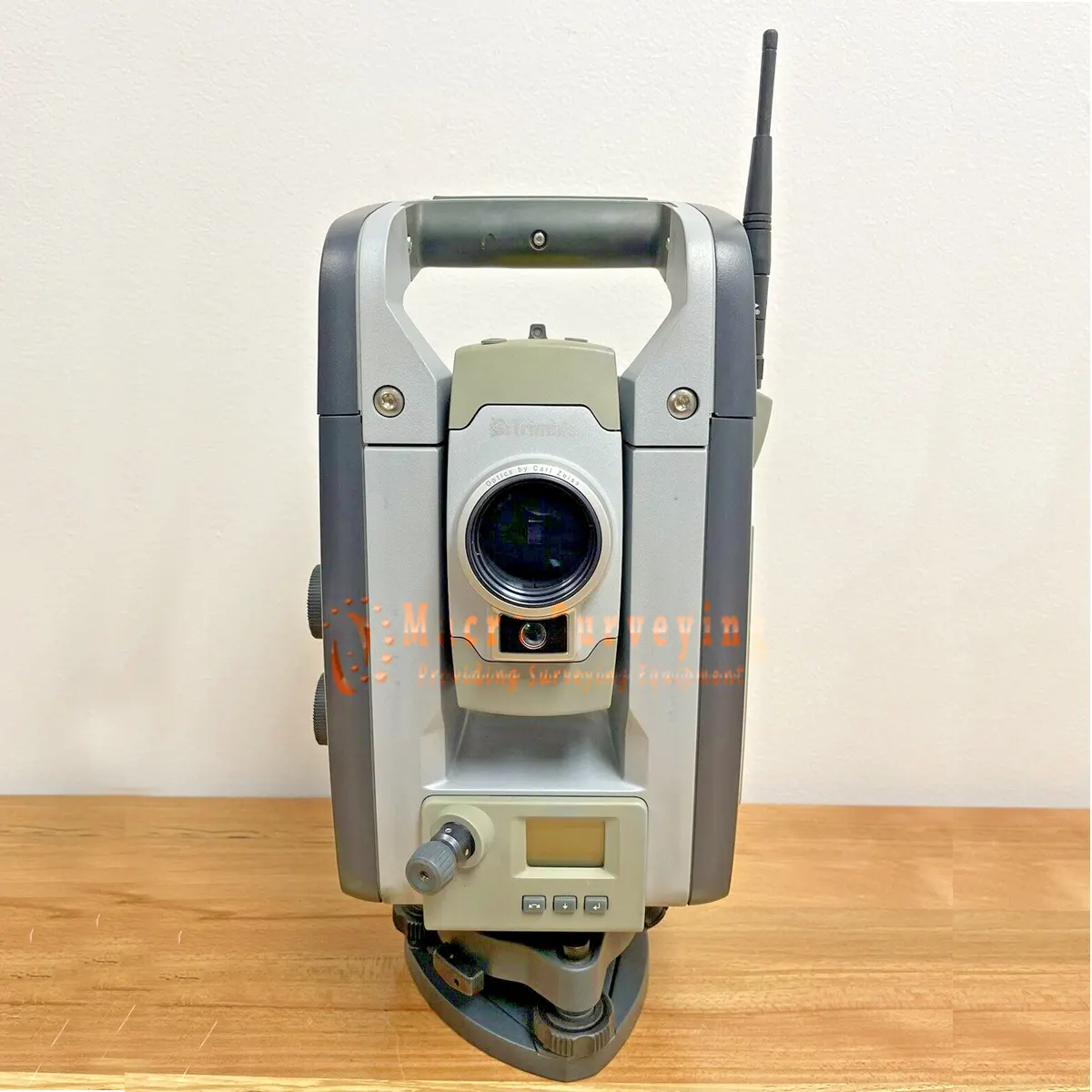
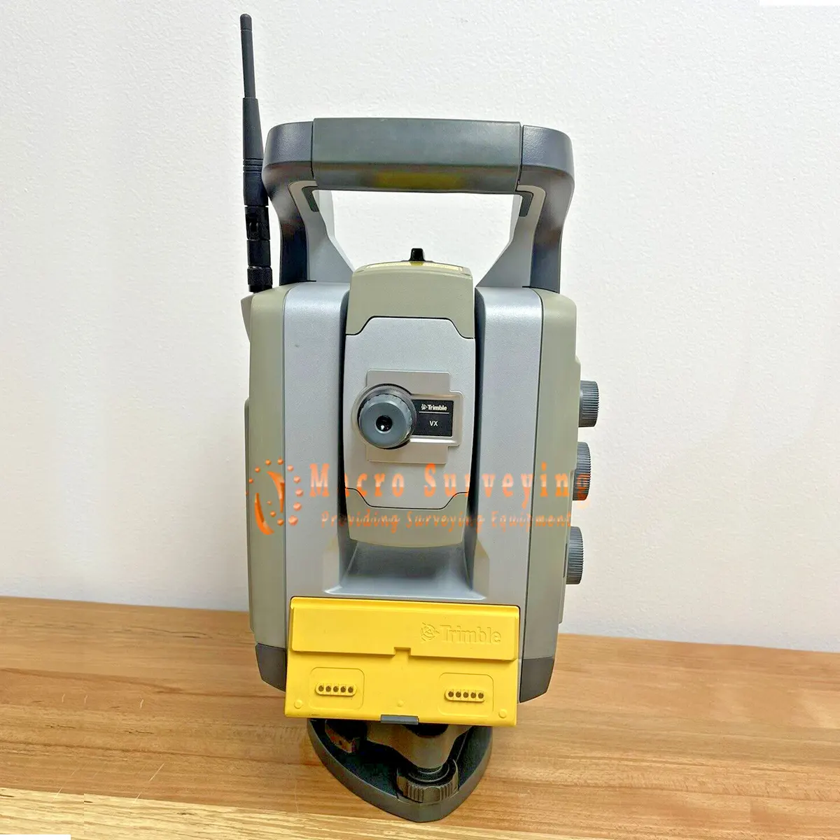
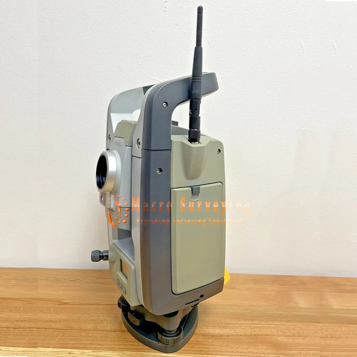

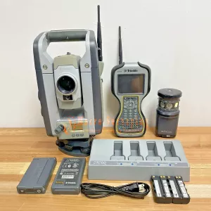
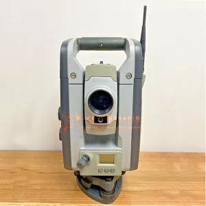

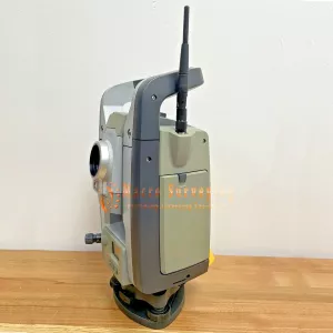
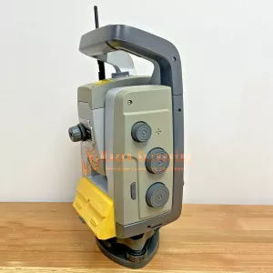
Trimble VX Spatial 1” robotic total station and 3D scanner setup. This unit is a 1” DR300+ fully robotic total station/3D scanner. The Trimble TCU is included and has Trimble Access with the scanning option. This instrument also has the built in video function so you see what the gun sees. The cradle has a 2.4GHz internal radio as well. Overall, everything is nice and clean and in proper working order. It has been fully checked, calibrated, and cleaned by authorized Trimble service.
Sale includes:
- 1X Trimble VX Spatial DR300+ 1” 3D Scanner Robotic Total Station
- 1X Trimble TCU with Internal 2.4GHz radio and Trimble Access software installed (with Scanning feature)
- 1X Trimble MT1000 Multitrack Prism
- 2X Battery packs. One for robotic holder and one for total station
- 1X Trimble 5 bay charger for the total station batteries
- 1X Trimble CD
- 1X Antenna for VX and for Cradle
- 1X Tribrach
- 1X Rain Cover
- 1X Trimble VX Carrying Case
- 1X Standard Yellow Trimble case to hold accessories
Trimble VX Spatial Robotic Total Station 3D Scanner with Trimble Access. Designed to capture shapes, detail, and coordinates, the Trimble VX offers an easy entry into Spatial Imaging. optimized for the acquisition of information using integrated video, scanning and positioning technologies. ideal solution for combining standard resolution 3D scans and digital imaging with survey-precise coordinate
Measurements and 2D deliverables:
- Intuitive video overlay provides visual cues on screen to speed data collection
- Spinning 115 degrees per second, MagDrive ™ servo movement ensures fast, efficient measuring
- Trimble VISION technology, enhances data deliverables with images captured at the jobsite
- Trimble VX measurements can be complemented with GNSS positioning for more flexibility in the field.
The Trimble VX Spatial Station is an advanced positioning system that uses leading optical and scanning technologies to measure in 3D for the production of 2D and 3D deliverables.
MEASURE TERRESTRIAL POINTS WITH ACCURACY AND EASE
The Trimble VX Spatial Station ensures measurement taking of ground-level points is efficient and accurate.
Trimble VISION Technology
Trimble VISION technology, specifically designed for Spatial Imaging, streams real-time digital images of your job site through the Trimble controller This capability saves time for remote and coarse aiming Users can select target points for measuring simply by tapping the Trimble controller touch screen at the appropriate points in the video stream.
Trimble VISION also enables users to view 3D data over the live video display of a job site. The ability to see in real time what objects have been measured gives Trimble VX users complete confidence that all required points have been taken, and reduces rework and duplication. A still digital image of the site can be captured from the video stream, so that the same benefits can be achieved back in the office - quality control and assurance.
3D Scanning
For applications such as 3D modeling and volume calculation, the Trimble VX includes a 3D scanning function - users can collect many points very quickly. The Trimble VX scanning function is excellent for measuring large surfaces; and scanned data can be easily combined with single point data.
An Advanced Hardware Platform
Built on the most advanced hardware platform of its kind, the Trimble VX includes Trimble MagDrive™ servos, which rotate the instrument with unequalled speed and agility. The instrument’s efficient movement ensures minimal waiting time between measurements MagDrive also provides the platform for Trimble VX scanning capabilities
DELIVER DATA IN THE LANGUAGE OF PICTURES
By combining rich 3D scanning data and VISION technology, the Trimble VX Spatial Station produces data that can be used to generate high-quality visual deliverables in the RealWorks Survey™ office software Because a picture is worth a thousand words, data recipients - whether colleague or client - can easily see what a job’s measurement data represents Review and approval of projects, and decision making, are more streamlined.
Colleagues receiving this “communicative data” can immediately see what points have been measured, and interact with the data without losing time trying to orient themselves in the results. At the same time, a business’ ability to communicate project data to clients impacts its bottom line - a client who can “catch the VISION” is much more likely to approve a bid.
BROADEN BUSINESS OPPORTUNITIES IN NEW APPLICATIONS
The Trimble VX Spatial Station creates opportunities in Transport and Civil Engineering; Utilities & Communications; Natural Resources Management; and Government and Military. Many of these applications use airborne geospatial information, but while airborne provides compelling and useful rooftop or one-sided views, the only way to present detailed eyelevel views is from the ground. A complete Spatial Imaging deliverable is possible through the fusion of airborne geospatial data and precise terrestrial measurements.
The Trimble VX is poised to rewrite the scope of services offered by “geospatial” businesses everywhere. It enables those businesses to produce the complete deliverables that their industry now demands.
General Specification
| PERFORMANCE | |
| Scanning (not enabled on all models) | |
| Range | From 1 m up to 250 m (3.28 ft–820 ft) |
| Speed | up to 15 points/sec, typical 5 points/sec |
| Minimum point spacing | 10 mm (0.032 ft) |
| Standard deviation | 3 mm @ ≤150 m (0.0098 ft @ ≤492 ft) |
| Single 3D point accuracy | 10 mm @ ≤150 m (0.032 ft @ ≤492 ft) |
| Angle accuracy | 1” (0.3 mgon) |
| Sensor type | Absolute encoder with diametrical reading |
| Automatic level compensator | |
| Type | Centered dual-axis |
| Accuracy | 0.5” (0.15 mgon) |
| Range | ±5.4' (±100 mgon) |
| Other distance measurement | |
| Accuracy (RMSE) | |
| Prism mode |
|
| DR mode |
|
| Measuring time | |
| Prism mode | Standard: 1.2 sec Tracking: 0.4 sec |
| DR mode | Standard: 1–5 sec Tracking: 0.4 sec |
| Range | |
| Prism mode (under standard clear conditions | |
| 1 prism | 2,500 m (8,202 ft) |
| 1 prism Long Range mode | 5,500 m (18,044 ft) (max. range) |
| Shortest possible range: | 0.2 m (0.65 ft) |
| DR mode | |
| White card (90% reflective) |
|
| Gray card (18% reflective) |
|
| Shortest possible range | 1 m (3.28 ft) |
| DR Ranges (typically) | |
| Concrete | 600–800 m (1,968–2,624 ft) |
| Wood construction | 400–800 m (1,312–2,624 ft) |
| Metal construction | 400–500 m (1,312–1,640 ft) |
| Light rock | 400–600 m (1,312–1,968 ft) |
| Dark rock | 300–400 m (984–1,312 ft)) |
| Reflective foil 20 mm | 1,000 m (3,280 ft) |
| Extended Range Mode | |
| White Card (90% reflective) | 2,000–2,200 m |
| Gray Card (18% reflective) | 900–1,000 m |
| Accuracy | 10 mm + 2 ppm (0.033 ft + 2 ppm) |
| ROBOTIC OPERATION | |
| Range | |
| Passive prisms | 500–700 m (1,640–2,297 ft) |
| Trimble MultiTrack Target | 800 m (2,625 ft) |
| Autolock pointing precision at 200 m (656 ft) (Standard deviation) | |
| Passive prisms | <2 mm (0.007 ft) |
| Trimble MultiTrack Target | <2 mm (0.007 ft) |
| Shortest search distance | 0.2 m (0.65 ft) |
| Type of radio internal/external | 2.4 GHz frequency-hopping, spread-sprectrum radios |
| Search time (typical) | 2-10 sec |
| SYSTEM SPECIFICATIONS | |
| Leveling | |
| Circular level in tribrach | 8'/2 mm (8’/0.007 ft) |
| Electronic 2-axis level in the LC-display with a resolution of | 0.3” (0.1 mgon) |
| Servo system | MagDrive servo technology, integrated servo/angle sensor electromagnetic direct drive |
| Rotation speed | 115 degrees/sec (128 gon/sec) |
| Rotation time Face 1 to Face 2 | 2.6 sec |
| Positioning speed180 degrees (200 gon) | 2.6 sec |
| Clamps and slow motions | Servo-driven, endless fine adjustment |
| Centering | |
| Centering system | Trimble 3-pin |
| Optical plummet. | Built-in optical plummet |
| Magnification/shortest focusing distance | 2.3x / 0.5 m to infinity (1.6 ft to infinity) |
| Telescope | |
| Magnification | 30x |
| Aperture | 40 mm (1.57 in) |
| Field of view at 100 m (328 ft) | 2.6 m at 100 m (8.5 ft at 328 ft) |
| Illuminated crosshair | Variable (10 steps) |
| Autofocus | Standard |
| Camera | |
| Chip | Color Digital Image Sensor |
| Resolution | 2048 x 1536 pixels |
| Focal length | 23 mm (0.07 ft) |
| Depth of field | 3 m to infinity (9.84 ft to infinity) |
| Field of view | 16.5° x 12.3° (18.3 gon x 13.7 gon) |
| Digital zoom | 4-step (1x, 2x, 4x, 8x) |
| Exposure | Automatic |
| Brightness | User-definable |
| Contrast | User-definable |
| Image storage | Up to 2048 x 1536 pixels |
| File format | JPEG |
| Compression ratio | User-definable |
| Video streaming | 5 frames/sec |
| Operating temperature | –20 ºC to +50 ºC (–4 ºF to +122 ºF) |
| Dust and water proofing | IP55 |
| Power supply | |
| Internal battery | Rechargeable Li-Ion battery 11.1 V, 4.4 Ah |
| Operating time | |
| One internal battery | Approx. 5 hours |
| Three internal batteries in multi-battery adapter | Approx. 15 hours |
| Robotic holder with one internal battery | Approx. 12 hours |
| Weight | |
| Instrument | 5.25 kg (11.57 lb) |
| Trimble CU controller | 0.4 kg (0.88 lb) |
| Tribrach | 0.7 kg (1.54 lb) |
| Internal battery | 0.35 kg (0.77 lb) |
| Trunnion axis height | 196 mm (7.71 in) |
| Communication | USB, Serial, Bluetooth |
| Security | Dual-layer password protection |
| EDM SPECIFICATIONS | |
| Light source | Pulsed Laser diode 905 nm; Laser class 1 |
| Laser pointer coaxial | Laser class 2 |
| Beam divergence Prism mode |
|
| Beam divergence DR mode |
|
| Atmospheric correction | –130 ppm to 160 ppm continuously |