Trimble Dini 0.7mm Accuracy Digital Level
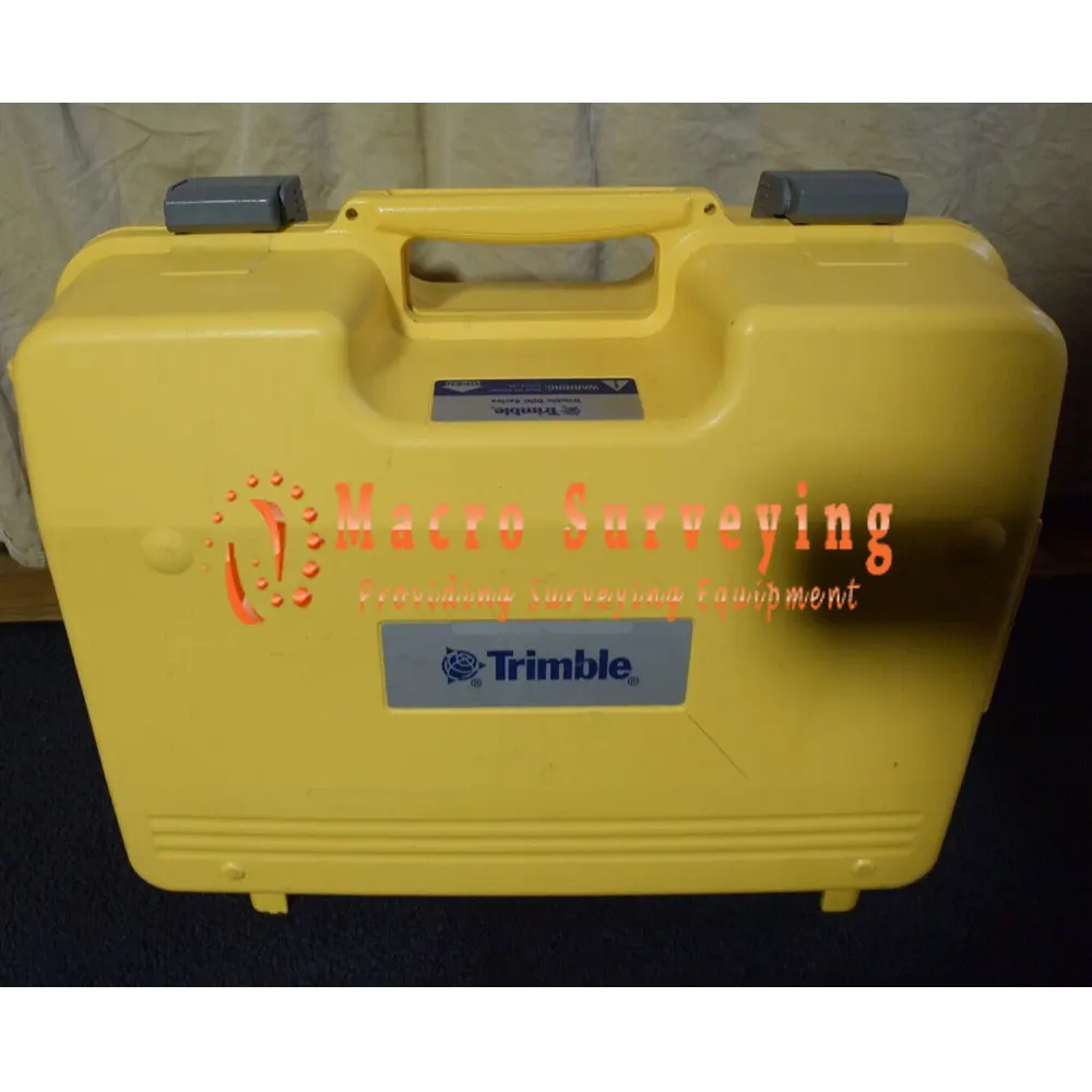
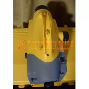
For sale used Trimble Auto Level Model Dini 0.7mm Accuracy. Sale come as pictured with Trimble Auto Level Model Dini with 2 batteries and carrying case. Auto Level is in very good looking condition and in correct working condition.
Condition: Used
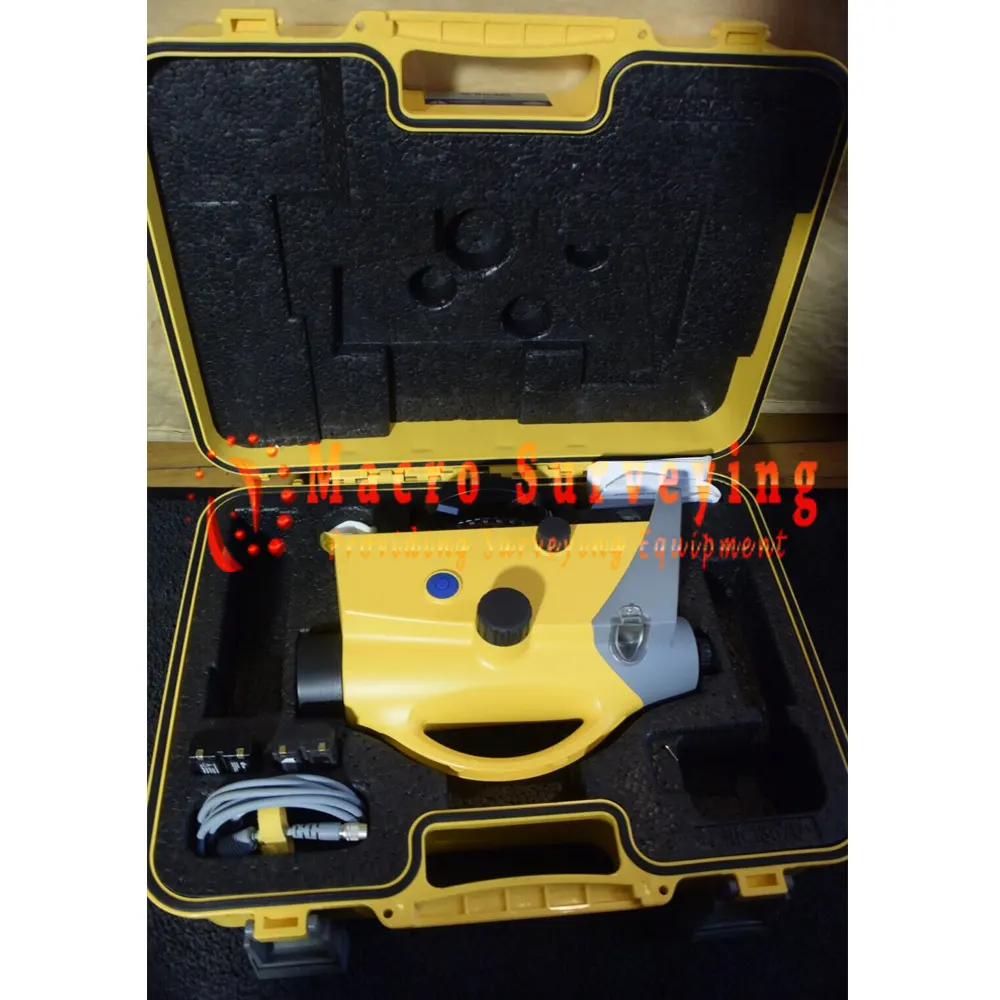


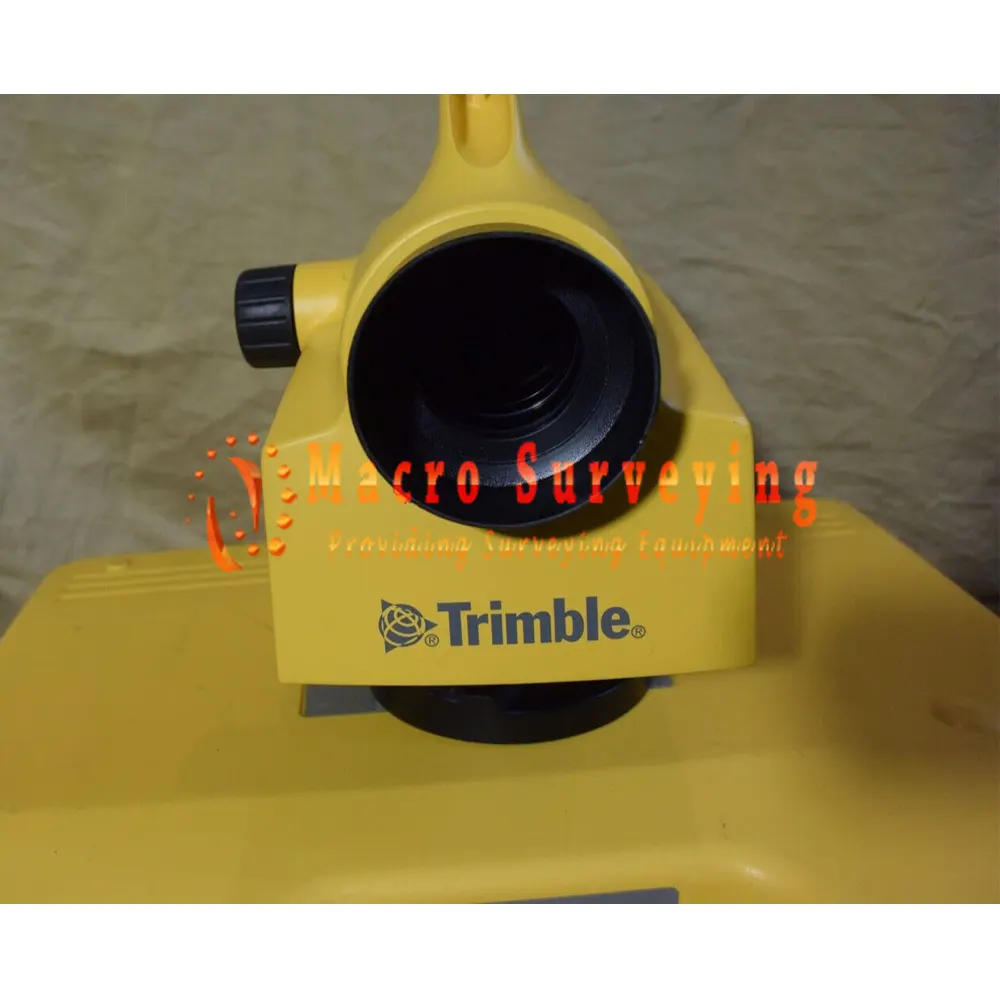


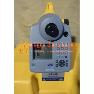
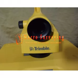

For sale Trimble Auto Level Model Dini 0.7mm Accuracy Manufactured in 2009. Auto Level is in very good looking condition and in correct working condition.
Package includes:
- Trimble Auto Level Model Dini 0.07mm Accuracy
- 2X batteries
- Charger
- Cable
- Carrying case
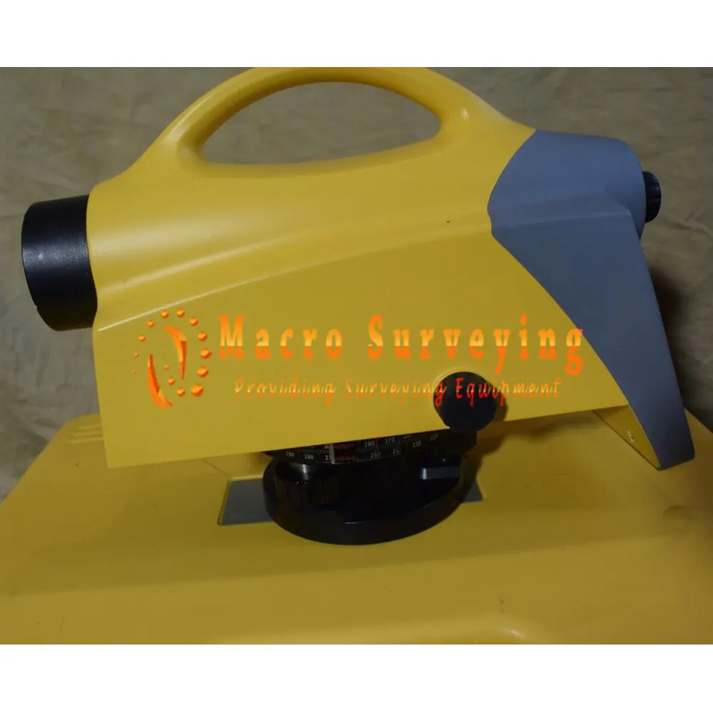
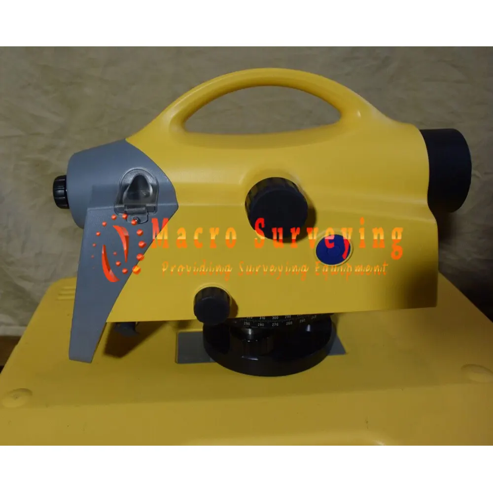
The Trimble® DiNi® Digital Level is a digital height measurement sensor from Trimble’s Integrated Surveying™ portfolio of products. The Trimble DiNi is a field-proven tool designed for any job site where fast and accurate height determination is required. Use the Trimble DiNi for applications such as precise leveling of flat and sloping surfaces, establishing the vertical component of grade and ground profiles, subsidence monitoring, and establishing the vertical component of control networks.
UNEQUALLED FOR PERFORMANCE IN THE FIELD
The Trimble DiNi is designed to perform optimally every day, whatever your surveying job. It is built rugged—with a dust- and waterproof rating of IP55—to take the tough conditions of the job site in its stride. A backlight in the screen and a light in the circular bubble keep you productive even when daylight gets low.
The DiNi will operate for three days without requiring a battery change, then when it does just recharge it as you would your Trimble GNSS system battery…the batteries are the same to ensure convenience and productivity.
When a job is complete, easily transfer data from the instrument to a computer by using a USB storage device; You don’t have to carry your instrument in to the office.
EASY TO LEARN, EASY TO USE
The Trimble DiNi Digital Level demands the industry’s smallest measurement field—just 30 cm of code rod. So you can measure greater change in height between the level and the rod in one setup, and save time. Additionally, the small measurement area:
- Reduces the number of stations needed by up to 20% because the Trimble DiNi is less impacted by a rod hidden by vegetation or hilly terrain.
- Makes leveling in low light conditions, for example, in tunnels, easier because only a very small part of the staff needs to be illuminated.
- Ensures greater accuracy through less influence of refraction near the ground.
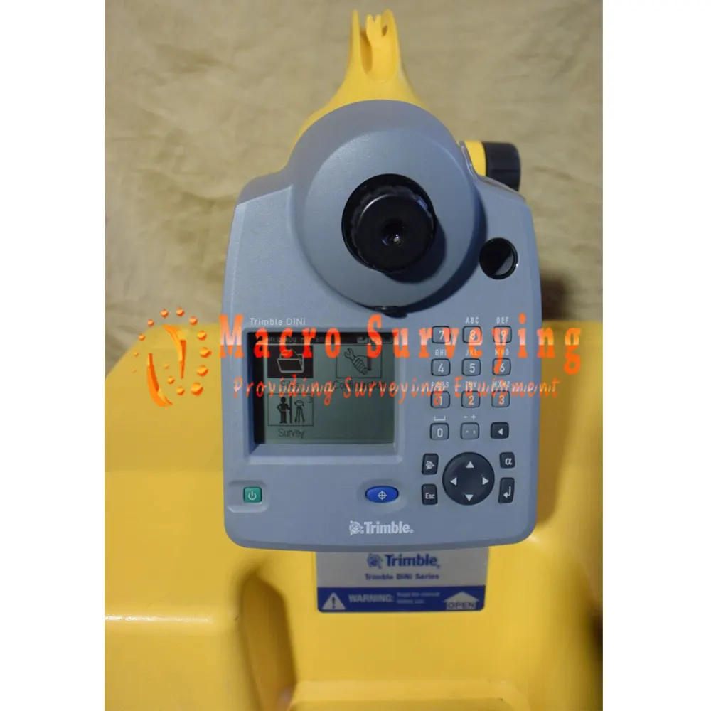
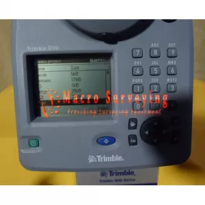
The large graphical display of the Trimble DiNi is also unique, and is complemented by the latest Trimble keyboard for easy operation. Crew members used to operating other Trimble systems will easily adapt to the Trimble DiNi.
TRIMBLE QUALITY AND ACCURACY FOR MEASURING WITH CONFIDENCE
The Trimble DiNi Digital Level is designed to support the rest of Trimble’s Integrated Surveying portfolio. The Trimble DiNi interface is based on Trimble’s other advanced and field-proven controllers for easy adoption of the instrument by your crews. Proven Optics by Carl Zeiss ensure the Trimble DiNi offers the highest precision and best resolution.
Measure with confidence, knowing that with the Trimble DiNi Digital Level, your crew will obtain the best quality results with the highest level of productivity.
Key Features
- Determine accurate height information via a quick and easy key press
- Eliminate errors and reduce rework with digital readings
- Enjoy effortless data transfer between instrument and office
- Measure to a measurement field of just 30 cm
- Level 60% faster than with conventional automatic leveling
Specifications:
| PERFORMANCE SPECIFICATIONS | |
| Accuracy | Standard deviation height measuring per 1 km (3280.84 ft) of double leveling |
| Electronic measurement | |
| Invar precision bar code staff | 0.7 mm (0.002 ft) |
| Standard bar code staff | 1.3 mm (0.004 ft) |
| Visual measurement | 2.0 mm (0.007 ft) |
| Distance measurement | with a 20 m (65.62 ft) sighting distance |
| Invar precision bar code staff | 25 mm (0.082 ft) |
| Standard bar code staff | 30 mm (0.098 ft) |
| Visual measurement | 0.3 m (0.984 ft) |
| Range | |
| Electronic measurement | 1.5 m–100 m (4.92 ft–328.08 ft) |
| Visual measurement | from 1.3 m (4.265 ft) |
| Electronic measurement | |
| Resolution height measurement | 0.1 mm / 0.001 ft / 0.001 in |
| Resolution distance measurement | 10 mm (0.033 ft) |
| Measurement time | 2 s |
| Horizontal Circle | |
| Type of graduation | 400 grads and 360 deg |
| Graduation interval | 1 grad and 1 deg |
| Estimation to | 0.1 grad and 0.1 deg |
| Measurement Programs | |
| Standard programs | Single measurement with and without stationing, stakeout, line leveling with intermediate sight and stakeout |
| Leveling methods | BF, BFFB, aBF, aBFFB |
| ENVIRONMENTAL | |
| Operating temperature | –20 °C to +50 °C (–4 °F to 122 °F) |
| Dust- and waterproofing | IP55 |
| GENERAL SPECIFICATION | |
| Telescope | |
| Aperture | 40 mm (0.131 ft) |
| Field of view at 100 m | 2.2 m (7.217 ft) |
| Electronic measurement field | 0.3 m (0.984 ft) |
| Magnification | 26 x |
| Compensator | |
| Inclination range | ±15’ |
| Setting accuracy | ±0.5” |
| Circular level | 8’/2 mm with Illumination |
| Display | Graphical, 240 x 160 pixels, monochrome with illumination |
| Keyboard | 19-key alpha-numeric and 4-way arrow key for navigation |
| Recording | |
| Internal memory | up to 30 000 data lines |
| External memory | USB Flash Drive support |
| Data transfer | USB Interface for data transfer between DiNi and PC (means two way communication) |
| Real-time clock and temperature sensor | N/A |
| Power supply |
|
| Weight | 3.5 kg (7.72 lb) including battery |