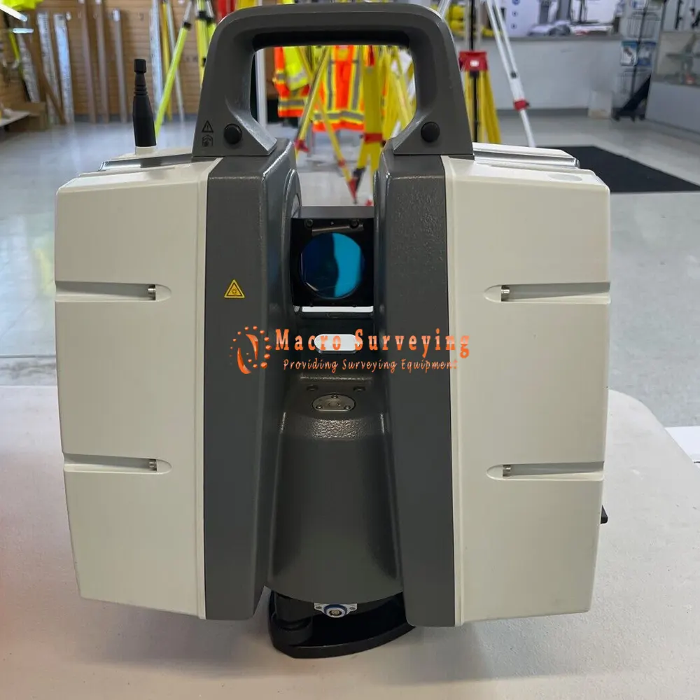
Leica ScanStation P40 Laser Scanner
Sale used Leica ScanStation P40-270M Survey Grade Laser Scanner. Minor wear and tear (see images), it functions flawlessly and has had very little use. Will supply 1yr CCP Basic and latest firmware version with purchase.
Condition: Used

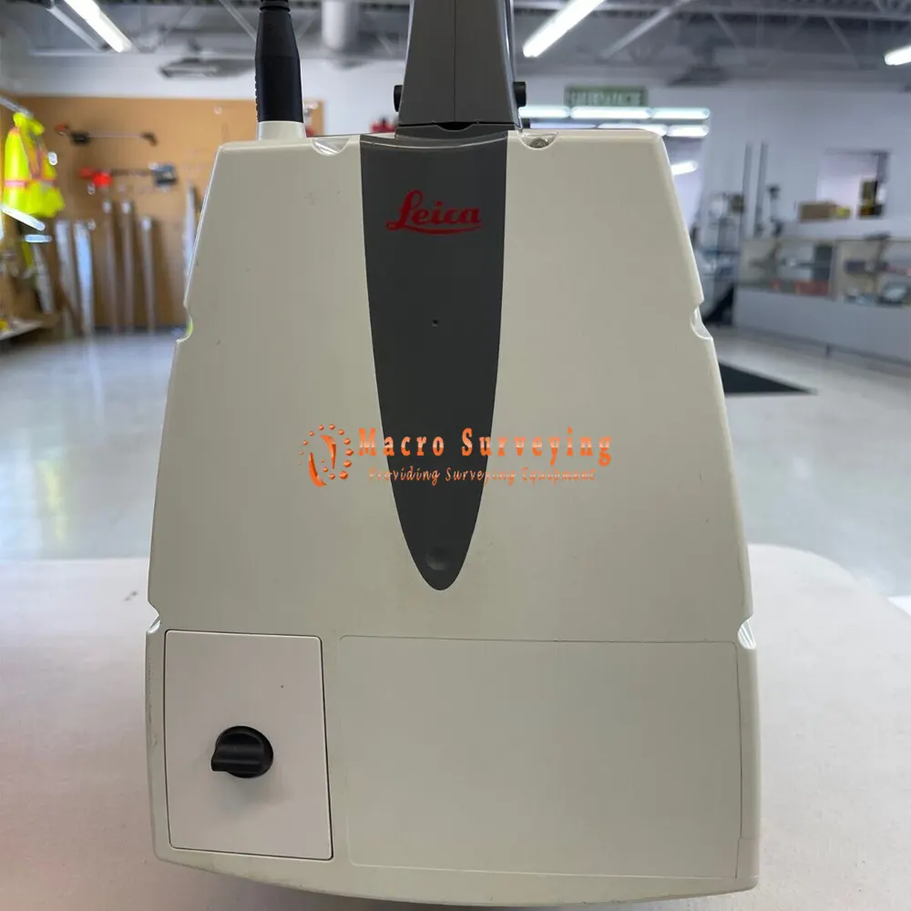

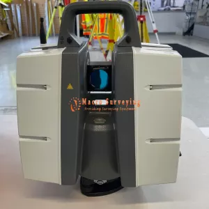
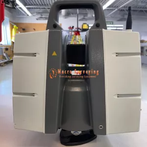

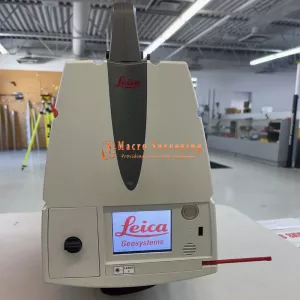

Used Leica P40 ScanStation for sale, year 2016, ready to work condition. We will include a 1yr CCP Basic with purchase. Scan like a professional for a fraction of the cost.
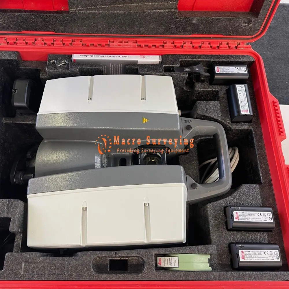
Used Leica P40 sale in complete kit includes;
- 1x ScanStation P40 Laser Scanner
- 1x GDF323 Tribrach without optical plummet
- 4x GEB242 Lithium-Ion Battery
- 1x GKL311 Single Charger Prof 3000
- 1x GEV228 Data Cable
- 1x GHM008 Scanner Height Meter
- 1x GHT196 Distance Holder for Height Meter
- 1x ScanStation P40/P30 Quick Guide
- 1x GVP645 Transport Box
- 30 Day return
Leica ScanStation P40 – High-Definition 3D Laser Scanning Solution
Leica ScanStation P-Series 3D laser scanners are your perfect partner when capturing 3D geometry of civil infrastructure, creating an as-built representation of a large industry complex, reconstructing a crime scene or generating 3D data for integration into Building Information Modelling (BIM). As part of the Leica Geosystems 3D Reality Capture solution, the Cyclone FIELD 360 app now links the 3D data acquisition in the field with the ScanStation P-Series laser scanner and final data registration in the office with Cyclone REGISTER 360. One-site, users can now automatically capture, register and examine scan and image data.
Leica ScanStation P30/P40 deliver highest quality 3D data and High-Dynamic Range (HDR) imaging at an extremely fast scan rate of 1 million points per second at ranges of up to 270m. Unsurpassed range and angular accuracy paired with low range noise and survey-grade dual-axis compensation form the foundation for highly detailed 3D colour point clouds mapped in realistic clarity.
The Leica ScanStation P40 is a high versatility scanner suitable for a wide range of typical scanning solutions. With its optimal mix of speed, range and accuracy paired with unmatched robustness it is the all-in-one solution for the most comprehensive variety of applications. Robust and of unsurpassed accuracy, the Leica ScanStation P40 laser scanner delivers high quality HDR imaging and 3D data at an extremely fast rate, and produces highly detailed 3D colour point clouds mapped in realistic clarity.
The ScanStation P40 offers highest versatility including long range capabilities. Delivering outstanding range, speed and data quality whenever and wherever needed it is the perfect solution for any tasks in 3D laser scanning.
Leica ScanStation P40 Specifications
| SYSTEM ACCURACY | |
| Accuracy of single measurement | |
| Range accuracy | 1.2mm + 10ppm over full range |
| Angular accuracy | 8” horizontal; 8” vertical |
| 3D position accuracy | 3mm at 50m; 6mm at 100m |
| Target acquisition | 2mm standard deviation at 50m |
| Dual-axis compensator | Liquid sensor with real-time onboard compensation, selectable on/off, resolution 1”, dynamic range ±5', accuracy 1.5” |
| DISTANCE MEASUREMENT SYSTEM | |
| Type | Ultra-high speed time-of-flight enhanced by Waveform Digitising (WFD) technology |
| Wavelength | 1550nm (invisible) / 658nm (visible) |
| Laser class | 1 (in accordance with IEC 60825:2014) |
| Beam divergence | < 0.23mrad (FWHM, full angle) |
| Beam diameter at front window | ≤ 3.5mm (FWHM) |
| Range and reflectivity | Minimum range: 0.4m |
Maximum range at reflectivity
|
|
| Scan rate | Up to 1,000,000 points per second |
| Range noise | 0.4mm rms at 10m |
| 0.5mm rms at 50m | |
| Field-of-View | Horizontal: 360° |
| Vertical: 290° | |
| Data storage capacity | 256GB internal solid-state drive (SSD) or external USB device |
| Communications/ Data transfer | Gigabit Ethernet, integrated Wireless LAN or USB 2.0 device |
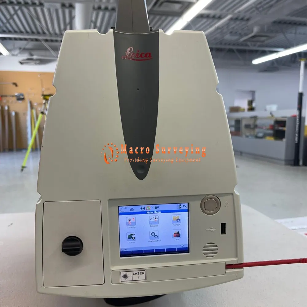
| Onboard display | Touchscreen control with stylus, full colour VGA graphic display (640×480 pixels) |
| Laser plummet | Laser class 1 (IEC 60825:2014) |
| Centring accuracy: 1.5mm at 1.5m | |
| Laser dot diameter: 2.5mm at 1.5m | |
| Selectable ON/OFF | |
| IMAGING SYSTEM | |
| Internal camera | |
| Resolution | 4 MP per each 17°×17° colour image |
| 700 MP for panoramic image | |
| Pixel size Video | 2.2µm Streaming video with zoom; auto-adjusts to ambient lighting |
| White balancing HDR | Sunny, cloudy, warm light, cold light, custom Tonemapped / full range |
| External camera | Canon EOS 60D/70D/80D/90D supported |
| POWER | |
| Power supply | 24 V DC, 100 – 240 V AC |
| Battery type | 2x Internal: Li-Ion; External: Li-Ion (connect via external port, simultaneous use, hot swappable) |
| Duration | Internal > 5.5h (2 batteries) |
| External > 7.5h (room temp.) | |
| ENVIRONMENTAL | |
| Operating temperature | –20°C to +50°C / –4°F to +122°F |
| Storage temperature | –40°C to +70°C / –40°F to +158°F |
| Humidity | 95%, non-condensing |
| Dust/Water | Solid particle/liquid ingress protection IP54 (IEC 60529) |
| PHYSICAL | |
| Scanner | |
| Dimensions (D x W x H) | 238 x 358 x 395 mm (9.4 x 14.1 x 15.6 in.) |
| Weight | 12.25kg / 27.0lbs, nominal (w/o batteries) |
| Battery (internal) | |
| Dimensions (D x W x H) | 40 x 72 x 77 mm (1.6 x 2.8 x 3.0 in.) |
| Weight | 0.4kg (0.9 lbs) |
| Mounting | Upright or inverted |
| CONTROL OPTIONS | |
| Full colour touchscreen for onboard scan control. Remote control: Leica CS10/CS15/CS20/CS35 controller or any other remote desktop capable device, including iPad, iPhone and other SmartPhones; external simulator. |
|
| Leica Cyclone FIELD 360 with tablet and SmartPhone (iOS and Android). | |
| Leica Cyclone FIELDWORX with Windows® Surface tablet. | |
| FUNCTIONALITY | |
| Survey workflows and onboard registration | Quick orientation, Set azimuth, Known backsight, Resection (4 and 6 parameters), Traverse |
| Check & Adjust | Field procedure for checking of angular parameters, tilt compensator and range offset |
| Onboard target acquisition | Target selection from video, scan or red laser beam |
| Onboard user interface | Switchable from standard to advanced |
| One button scan control | Scanner operation with one button concept |
| Scan area definition | Scan area selection from video or scan; batch job scanning |
| Double scan | Automatic removal of point cloud noise introduced by moving objects |