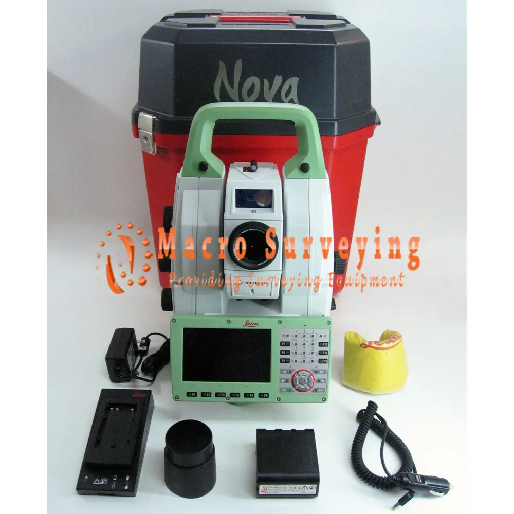
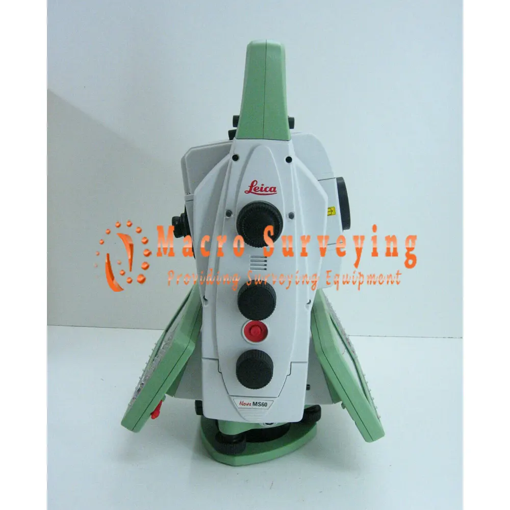
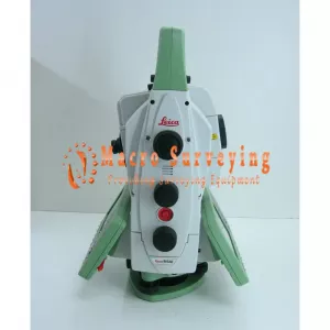
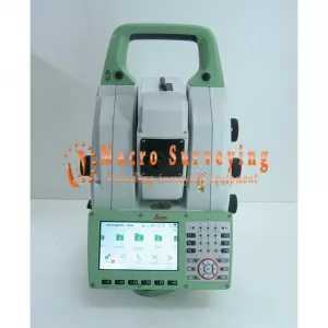
Leica Nova MS60 1" R2000 MultiStation Robotic
Up for sale Leica Nova MS60 1” (0.3mgon) R2000 MultiStation ROBOTIC Surveying, the ultimate all-rounder, a scanning, self-learning total station with GNSS connectivity and digital imaging
Condition: Used


Up for sale Leica Nova MS60 1” (0.3mgon) R2000 MultiStation ROBOTIC Surveying, the ultimate all-rounder, a scanning, self-learning total station with GNSS connectivity and digital imaging
Leica Nova MS60 sale includes:
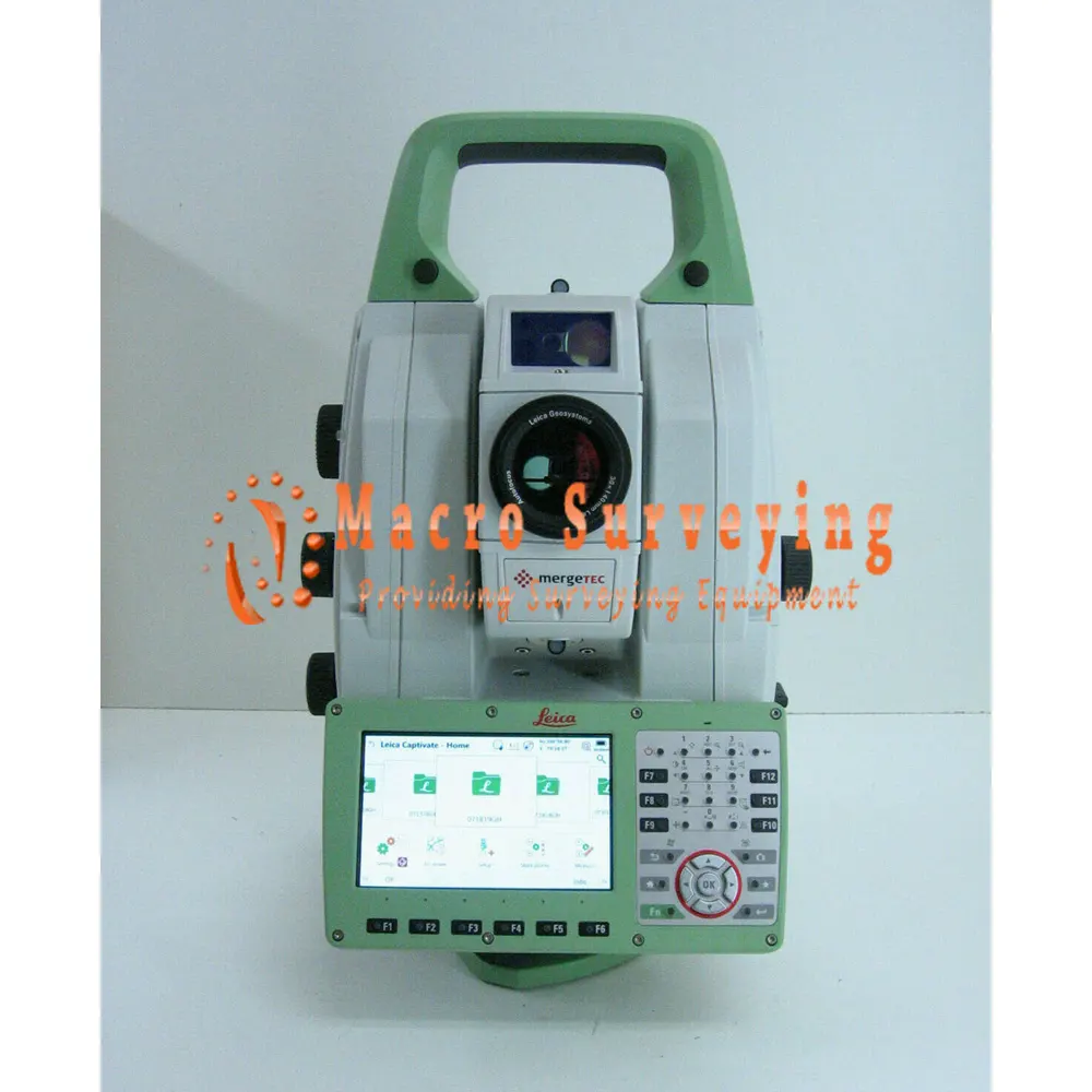
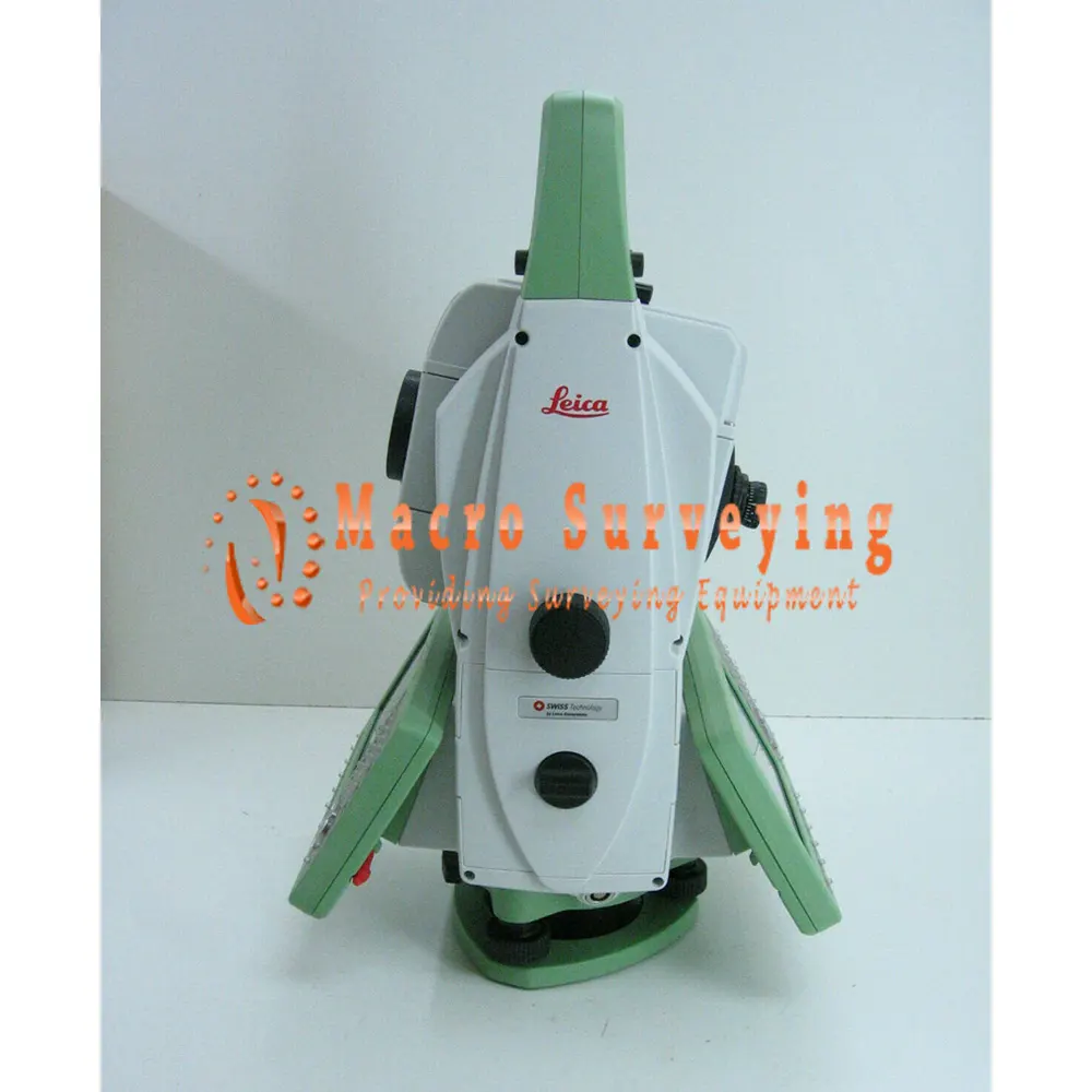
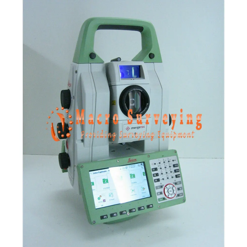
- Leica Nova MS60 1” (0.3mgon) MultiStation with reflectorless EDM (R2000) and high-speed 1000Hz EDM
- Leica Captivate software- Measure & Stakeout
- Automatic target recognition,
- PowerSearch,
- 5MP imaging, overview camera,
- 30x telescope camera,
- Autofocus,
- WLAN,
- Bluetooth,
- RS232/USB interface,
- RadioHandle interface,
- USB stick/SD card interface,
- 2GB eMMC Flash Memory,
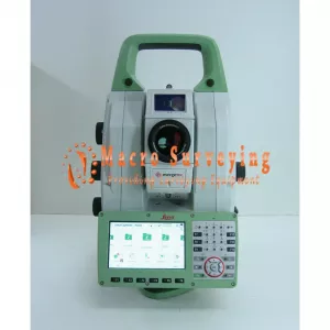
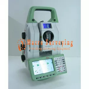
- 1GB SDRAM, 2 keyboards with 5” WVGA color touch screen,
- Laser plummet,
- 2X GEB242 batteries
- GKL341 Pro Charger
- SD Memory card 8GB
- GDF321 Tribrach
- Quick Guide
- upright container.
- 30 Day return
LEICA NOVA MS60 MULTISTATION: THE SCANNING ROBOTIC TOTAL STATION
The ultimate all-rounder, a scanning, self-learning total station with GNSS connectivity and digital imaging
The new version of Leica Nova MS60, the world’s first MultiStation, enables you to perform all surveying tasks with one instrument. It brings sensor fusion to the next level by combining:
- Highest-end total station capabilities
- 3D laser scanning, enabling you to scan up to 30’000 points per second
- GNSS connectivity
- Digital imaging
The MS60 is a scanning total station that empowers complete data collection of individual points and large areas by leveraging sensor fusion and automation. Seamlessly integrated into Leica field and office surveying software, you can quickly complete your work on-site and offer a range of high-value deliverables.
Highest-end total station
Highly accurate angle and distance measurements, robust design and easy-to-use apps. With improved automated functionalities, like Dynamic Lock and Autoheight, and the self-learning ARTplus features, the MS60 increases your efficiency, even in the most challenging conditions.
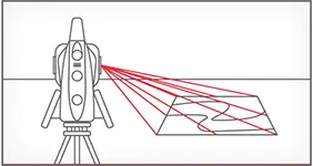 3D Laser Scanning
Scan up to 30,000 points per second (Hz) to complete your work quickly and get dense scanning grids. The MS60 features optimised scanning paths, including zenith scans, allowing you to significantly reduce the total scanning time.
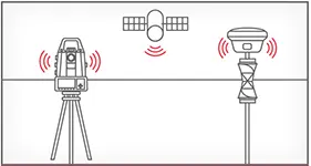
GNSS connectivity
GNSS is fully integrated in the workflow and the data structure, enabling direct georeferencing and increasing your flexibility in the field.
 Digital imaging
Digital imaging technology, including an overview and a 30x magnifying telescope camera, enables accurate image-assisted surveying both at the instrument and remotely, while also including extended image documentation.
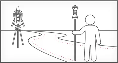
 When to use the Leica Nova MS60
Traditional surveying and so much more. Learn ways our scanning total station enables measurement tasks and deliverables for a range of sites and structures.
- Surfaces and volumes in construction and mining, soil heaps and stockpiles, DTM creation and checking surfaces, material thickness, blast faces and ground levels
- Analysis of complex structures and objects within plant, marine and utility projects: dimensional control, as-built and record keeping
- Measuring buildings and structures: bridge condition/clearance analysis, BIM and as-built
- Facade, elevations and heritage work: creation of traditional deliverables like 2D maps or 3D models
- Deformation monitoring of structures and ground: automated or periodic measurements of buildings, transportation infrastructure, natural hazards, dams and other objects
Integrated surveying, monitoring and CAD software
- Leica Captivate - the MS60’s onboard software with easy-to-use apps that cover all your surveying tasks. Includes a range of tools to optimise scanning tasks, like the Inspect Surface app and more.
- Leica Infinity - an intuitive surveying office software enabling seamless data transfer from the MS60 to the office to manage, process, analyse and quality check your field data.
- Leica GeoMoS - the automated deformation monitoring software providing movement analysis, reports and notifications
- Leica Cyclone - point cloud processing, management, collaboration and visualisation software.
- Leica Cloudworx - CAD plugins that allow you to work efficiently with large point clouds directly in your chosen CAD system
- Additional Hexagon packages and selected partner software
Scanning with the Leica Nova MS60 has been made simpler through the instant creation of point clouds with overlaid measured points and 3D models in one view. Visualisations are clearer and easier to see on an all-new 5” screen. The unique capabilities of the Leica Nova MultiStation truly deliver the new experience in measuring technology.
The Leica Nova MS60 MultiStation comes with the revolutionary Captivate software, turning complex data into the most realistic and workable 3D models. With easy-to-use apps and familiar touch technology, all forms of measured and design data can be viewed in all dimensions. Leica Captivate spans industries and applications with little more than a simple swipe, regardless of whether you work with GNSS, total stations or both.
While Leica Captivate captures and models data in the field, Leica Infinity processes the information back in the office. A smooth data transfer ensures the project stays on track. Leica Captivate and Leica Infinity work in conjunction to join previous survey data and edit projects faster and more efficiently.
Leica MS60 Spesification:
| Angle Measurement | ||
|
Accuracy Hz and V |
Absolute, continuous, quadruple | 1” (0.3 mgon) |
| Distance measurement | ||
| Range / Accuracy / Measurement time | Prism (GPR1, GPH1P) | 1.5m to >10,000m / 1mm + 1.5ppm / typ. 1.5s |
| Single (any surface) | 1.5m to 2,000m / 2mm + 2ppm / typ. 1.5s | |
| Measurement technology | Wave Form Digitising | Coaxial, visible red laser, dot size 8mm x 20mm @ 50m |
| Scanning | ||
|
Scan Rate / Maximum Scan Speed |
30.000 Hz |
30,000 points per second |
| Max. Range / Range noise (1 sigma) | 30 kHz mode | 60m / 3mm @ 50m |
| 8 kHz mode | 150m / 1.5mm @ 50m | |
| 1 kHz mode | 300m / 1.0mm @ 50m | |
| 1 Hz mode | 1,000m / 0.6mm @ 50m | |
| Scan data | 3D point cloud including true colour, intensity and signal-to-noise data | |
| Scan duration | Full dome scan 400gon x 155gon | Resolution 50mm @ 15m, duration 12mins |
| Band Scan 400gon x 50gon | Resolution 12.5mm @ 50m, duration 45mins | |
| Imaging | ||
| Overview and telescope camera | Resolution / Frame rate | 5 MPx CMOS / up to 20 fps |
| Field of view (overview / telescope) | 19.4° / 1.5° | |
| Motorisation | ||
| Direct drives based on Piezo technology | Rotation speed / Time to change face | Maximum 400 gon (360°) per s / typically 2.9s |
| Automatic Aiming - ATRplus | ||
| Target aiming range / Target locking range | Circular prism (GPR1, GPH1P) | 1,500m / 1,000m |
| 360° prism (GRZ4, GRZ122) | 1,000m / 1,000m | |
| Accuracy / Measurement time | ATRplus angle accuracy Hz, V | 1” (0.3 mgon) / typically 2.5s |
| PowerSearch | ||
| Range / Search time | 360° prism (GRZ4, GRZ122) | 300m / typically 5s |
| Guide Light (EGL) | ||
| Working Range / Accuracy | 5–150m / typically 5cm @ 100m | |
| General | ||
| Operating system / Field software | Windows EC7 / Leica Captivate and its apps, supports onsite and realtime decisions | |
| Processor | TI OMAP4430 1GHz Dual-core ARM® Cortex™- A9 MPCore™ | |
| Autofocus telescope | Magnification / Focus Range | 30 x / 1.7m to infinity |
| AutoHeight Module | Distance accuracy | 1.0 mm (1 Sigma) |
| Distance range | 0.7 m to 2.7 m | |
| Display and Keyboard | 5“ (inch), WVGA, colour, touch, both faces | 37 keys, illumination |
| Operation | 3x endless drives, 1x Servofocus drive, 2x Autofocus keys, user-definable SmartKey | |
| Power management | Exchangeable Lithium-Ion battery | Up to 9h, internal charging capability |
| Data storage | Internal memory / Memory card | 2 GB / SD card 1 GB or 8 GB |
| Interfaces |
|
|
| Environmental specifications | Working temperature range | –20°C to +50°C |
| Dust & Water (IEC 60529) / Blowing rain | IP65 / MIL-STD-810G, Methods 506.5 I and 507.5 | |
| Humidity | 95%, non-condensing | |
| Weight | 7.7 kg MultiStation incl. battery | |