Leica GPS GX1230 GG RTK Base Rover
Sale Leica GX12300GG base rover, AX1202GG antennas and all necessary accessories, perfect ready to working order condition with recent Leica calibration history
Condition: Used


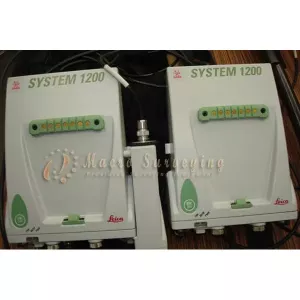

Leica GX12300GG base and rover for sale included Leica AX1200 GG L1/L2 GPS Antennas and all necessary accessories. System condition is in absolutely in perfect ready to working order condition with recent Leica calibration certificate
Manufactured: 2008
Condition: Excellent
Latest Firmware
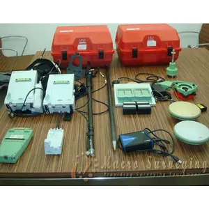
This sale includes everything and ready to survey:
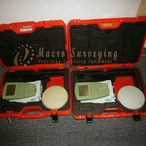
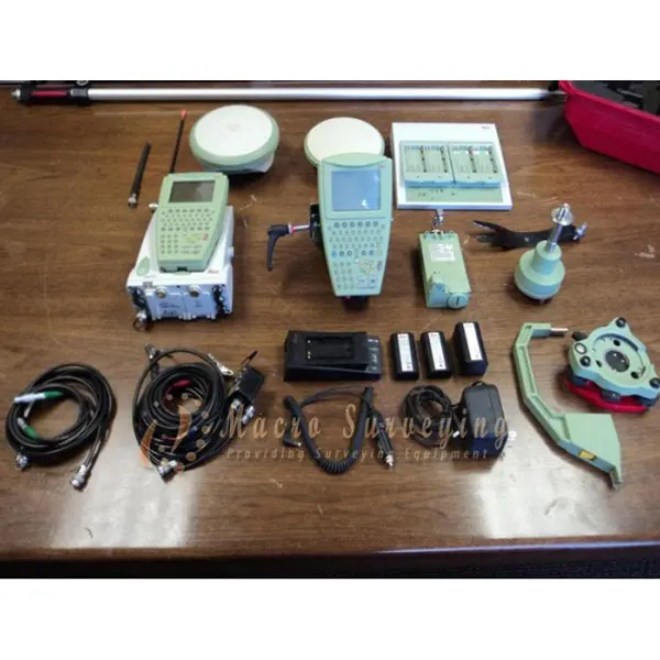
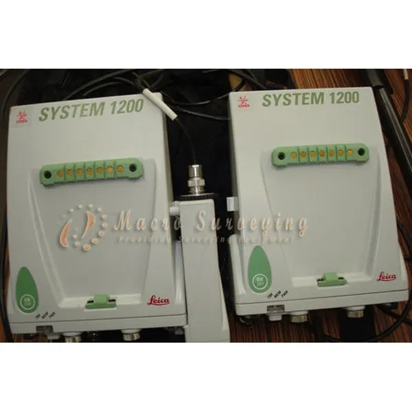
- 2x GX1230GG GPS/GLONASS Dual Frequency RTK Receivers
- 2x AX1202GG Dual Frequency GPS Antenna
- 1x RX1210T GPS1200 Controller with Touch Screen
- 1x GDF112, Basic Tribrach
- 1x Card Reader
- 1x 256MB compact Flash card
- 1x Leica Geo Office including Autocad Export USB dongle
- 1x Height Hook
- 1x Carrier
- 1x GEV163 cable
- 2x GFU24 GSM/GPRS modem
- 2x GAT 3 antennas
- 4x GEB221 batteries
- 1x Carbon Fibre pole together with Grip, holder and clamp
- 2x GVP Hard Containers
- 1x Minipack
- 1x Smartworx V8.5
- All necessary cables for proper setup
Leica GPS 1230 GG full RTK reference and rover system, GPS and GLONASS, with additional Reference Line program. Coupling the versitility of the Leica 1200 system with a choice of low and high power radios.
The System 1200 GG system was launched with an ultra-precise GNSS measurement engine that supports both GPS and GLONASS, benefiting from up to 100% more satellites than GPS only. Built to the toughest MIL specifications they will withstand extreme temperatures, the worst conditions and the toughest site conditions.
Designed for a temperature range from -40?C to +65?C and fully waterproof to 1m, sand and dust proof the GPS1200 will keep working long after you give up.
Weighing just 2.8kg the 1200 GPS system is light and versatile. The system can be used as a base or rover in any mode from static to RTK. It can be used on a pole, on a tripod, in a minipack or even on a construction machine, survey boat or aircraft.
Additional programs can increase the versatility of the system, with specially designed programs for stakeout, calculating volumes or seismic recoding.