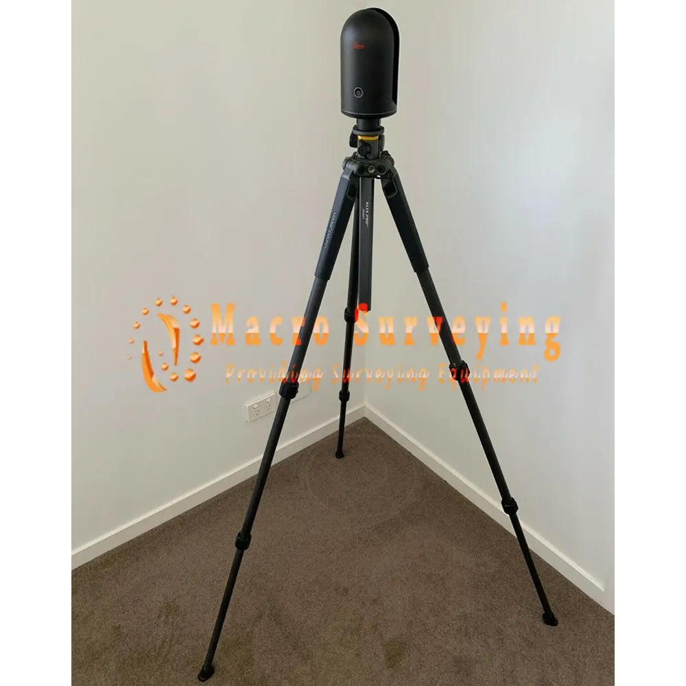
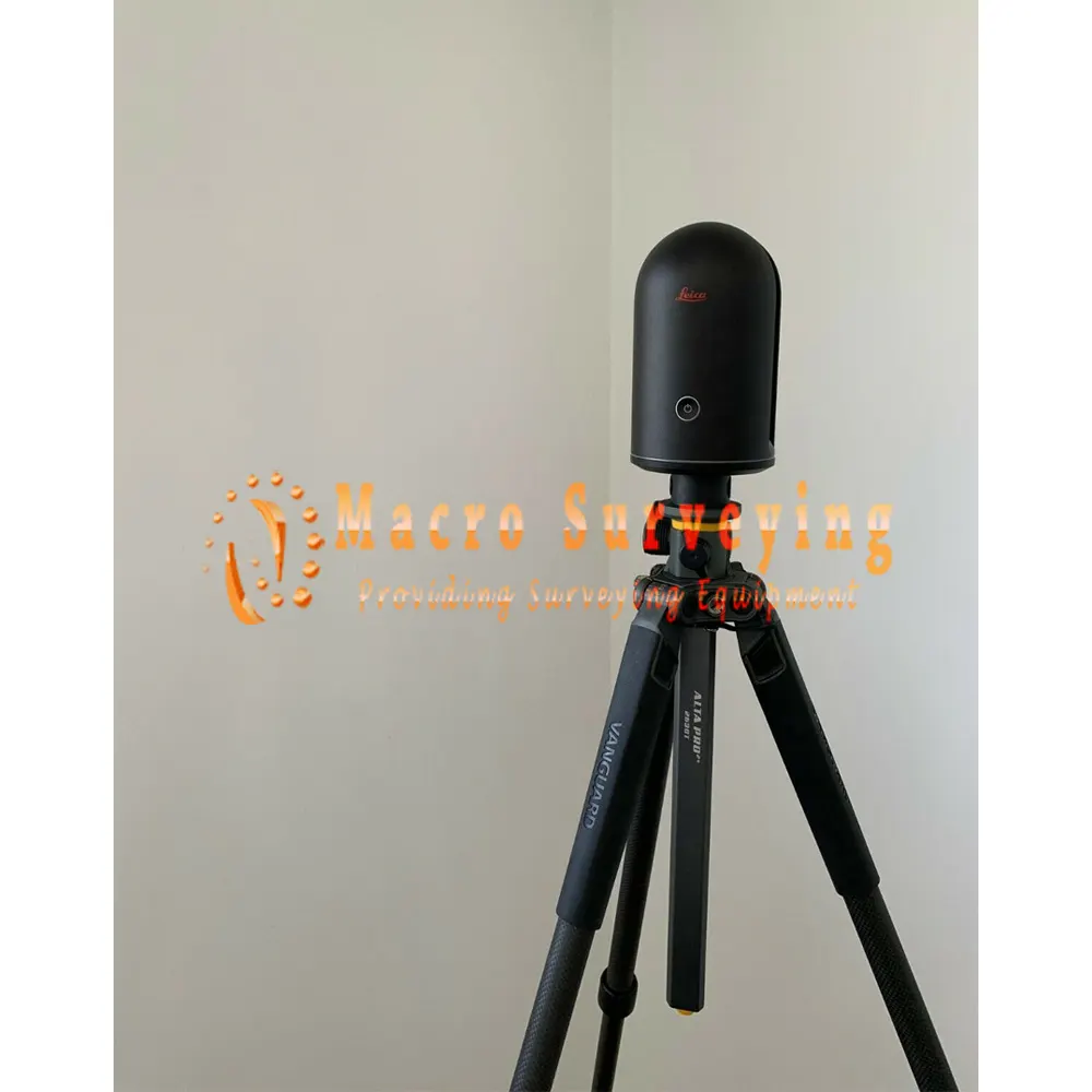
Leica BLK360 3D Laser Scanner
Sale used Leica BLK360 Laser Scanner, full kit includes iPad Pro , Leica DISTO D2, Leica HDS 6 Black and White Targets, Vanguard Alt Pro 2, Been inspected and calibrated by Leica
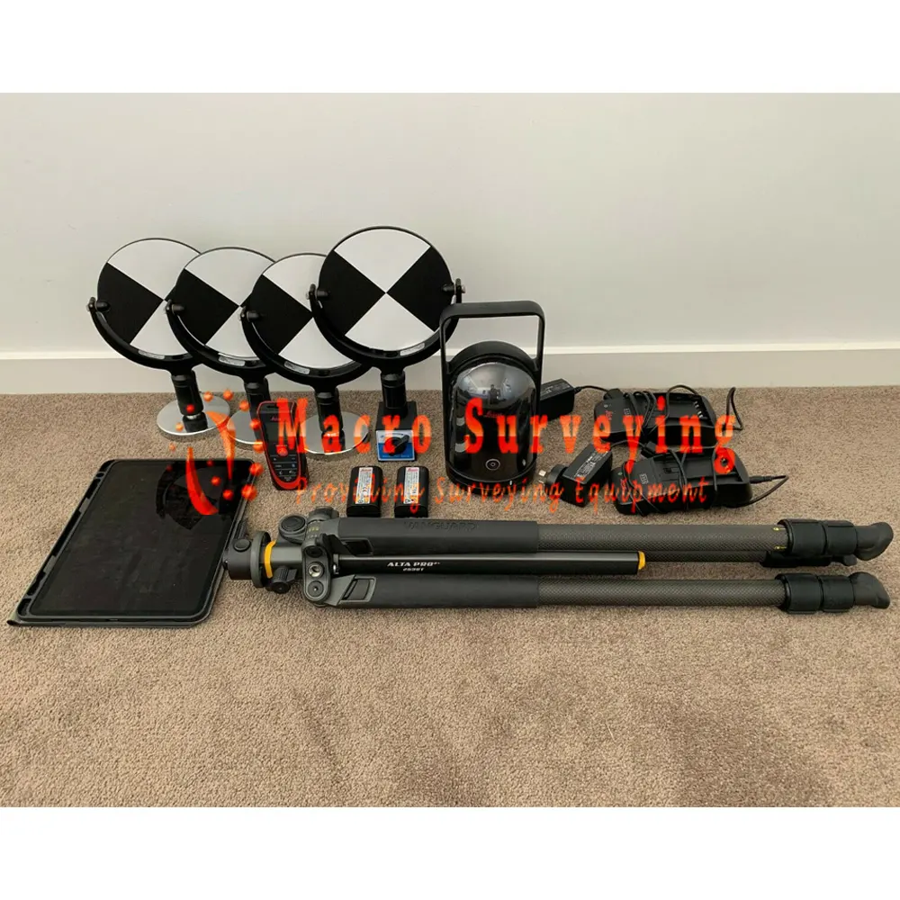
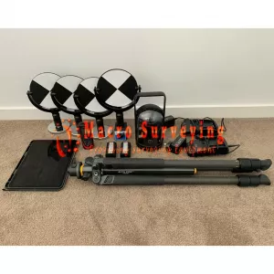


Sale used Leica BLK360 3D Laser Scanner, full kit includes iPad Pro , Leica DISTO D2, Leica HDS 6 Black and White Targets, Vanguard Alt Pro 2. Been inspected and calibrated by Leica, everything is in great condition and ready to working to scan
Full kit for generating pointcloud for design purposes. For Architects, Building Designers, Surveyors, Quantity Surveyors and Draftspersons, this scanner will set you apart from your competition and give you a competitive edge.
Package includes:
- 1 x Leica BLK360 Laser Scanner (including hard protective case)
- 1 x Apple iPad Pro 11” 256GB including tough case
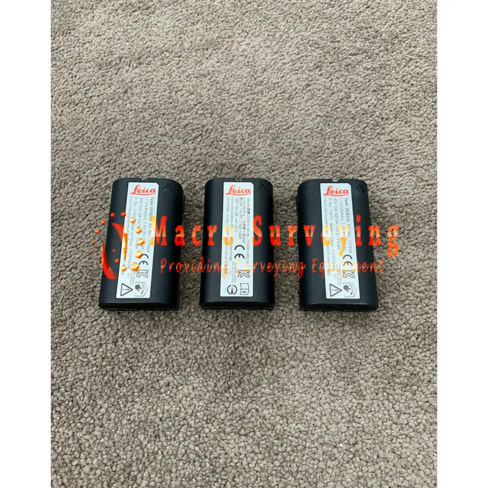
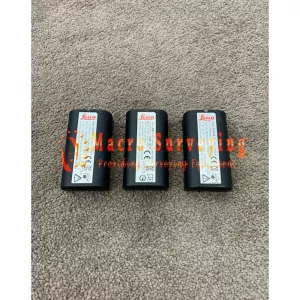
- 3 x Leica GEB212 2.6Ah Li-Ion Battery
- 2 x Leica GKL312 Single Bay Battery Charger for BLK360
- 1 x Leica GAD52 BLK360 Tripod Adapter with Quick Release for 1/4”
- 1 x Vanguard Alt Pro 2+ 263CT Carbon Fibre Tripod (including carry case)
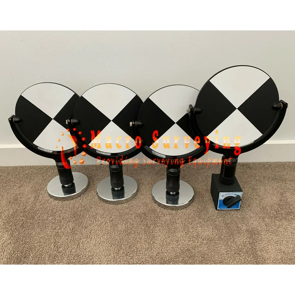
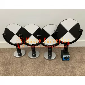
- 4 x Leica HDS 6 Black and White Targets (including carry case)
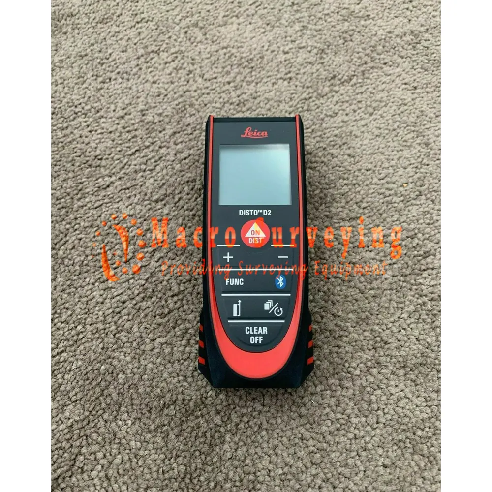
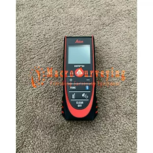
- 1 x Leica DISTO D2 (including protective case)
- 1 x Leica GVP735 Mission Bag for BLK360
This full Leica 3D scanning kit will allow us to begin laser scanning and generating pointcloud data straight away. With everything needed to start, the user can generate pointcloud data sets then interrogate the data, create models or BIM. This scanner is accurate generally accurate to 10-30mm (check with manufacturers specifications). The buyer will need a scanning software of choice, such at Audodesk ReCAP 360 Pro. There are several other scanning software solutions that might better suit your requirements.
Leica BLK360 Laser Scanner
An imaging laser scanner for both beginners and professionals.
The award-winning Leica BLK360 G1 is the original Leica BLK laser scanner, packed with features that make it reliable, precise, and easy to use. A scanner that’s perfect for those new to reality capture, it could be the right piece of kit for your laser scanning workflow.
The BLK360 captures 360,000 points per second, panoramic HDR imagery, and has thermal imaging capability. It is fully compatible with the Leica Geosystems Cyclone suite of Reality Capture software and powerful enough to be a useful addition to an experienced surveyor’s toolkit.
Features of Leica BLK360 Imaging Laser Scanner
- smallest and lightest laser scanning system in the world
- Weight: 2.2 lbs, Size: 6.5” tall x 4” in diameter
- Less than 3 minutes for a full 360° reality capture
- Speed of capture 360,000 points per second
- Range 60m radius
- 3-D image point cloud available in real time
- Selectable resolution settings
- Calibrated full spherical image, HDR, LED flash support
- Control all aspects of the reality capture process remotely on Cyclone Field 360 app for Apple or Android
- Automatically register and visualize scan data in the field
- Mark up, tag, and collaborate on scans while on the job site
- Reduce rework requests and share reality data remotely
- IP54 Liquid & Dust Protection
Specifications:
| GENERAL | |
| Imaging scanner | 3D scanner with integrated spherical imaging system and thermography panorama sensor system |
|
DESIGN & PHYSICAL |
|
| Housing | Black anodized aluminium |
| Dimensions (H x D) | 165 x 100 mm |
| Weight | 1 kg |
| Transport cover | Hood with integrated floorstand |
| Mounting mechanism | Button-press quick release |
|
OPERATION |
|
|
Standalone operation |
One-button operatio |
|
Remote operation |
iPad app, Apple iPad Pro® 12.9”/iOS 10 or later |
| Wireless communication | Integrated wireless LAN (802.11 b/g/n) |
| Internal memory | Storage for > 100 setups |
| Instrument orientation | Upright and upside down |
|
POWER |
|
| Battery type | Internal, rechargeable Li-Ion battery (Leica GEB212) |
| Capacity | Typically >40 setups |
|
SCANNING |
|
| Distance measurement system | High speed time of flight enhanced by Waveform Digitizing (WFD) technology |
| Laser class | 1 (in accordance with IEC 60825-1:2014) |
| Wavelength | 830 nm |
| Field-of-view | 360° (horizontal) / 300° (vertical) |
| Range | min. 0.6 - up to 60 m |
| Point measurement rate | up to 360’000 pts / sec |
| Ranging accuracy | 4mm @ 10m / 7mm @ 20m |
| Measurement modes | 3 user selectable resolution settings |
| IMAGING | |
| Camera system | 15 Mpixel 3-camera system, 150Mpx full dome capture, HDR, LED flash Calibrated spherical image, 360° x 300° |
| Thermal Camera | FLIR technology based longwave infrared camera Thermal panoramic image, 360° x 70° |
| Image modes |
|
| PERFORMANCE | |
| Measurement speed | < 3 min for complete fulldome scan, spherical image & thermal image |
| 3D point accuracy | 6mm @ 10m |
| ENVIRONMENTAL | |
| Robustness | Designed for indoor and outdoor use |
| Operating temperature | +5 to +40° C |
| Dust/Humidity | Solid particle/liquid ingress protection IP54 (IEC 60529) |
|
DATA ACQUISITION |
|
| Live image and scanned data streaming | |
| Live data viewing and editing | |
| Automatic tilt measurements | |