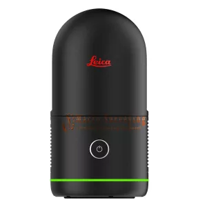
Leica BLK360 3D Imaging Laser Scanner
All-new Leica BLK360 G2 3D Imaging Laser Scanner, Immersive HDR Imaging, VIS Scan Alignment System, Ultra-fast Scanning, High-Speed Data Transfer, Smallest Laser Scanner
Condition: New


The all new Leica BLK360 G2, Immersive HDR Imaging, VIS Scan Alignment System, Ultra-fast Scanning, High-Speed Data Transfer, Smallest Laser Scanner. Next Generation Imaging Laser Scanner, breaks open the possibilities of reality capture. With unprecedented, best-in-class scanning speed, the BLK360 makes you faster.
Package includes;
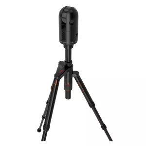
- Leica BLK360 G2 Laser Scanner
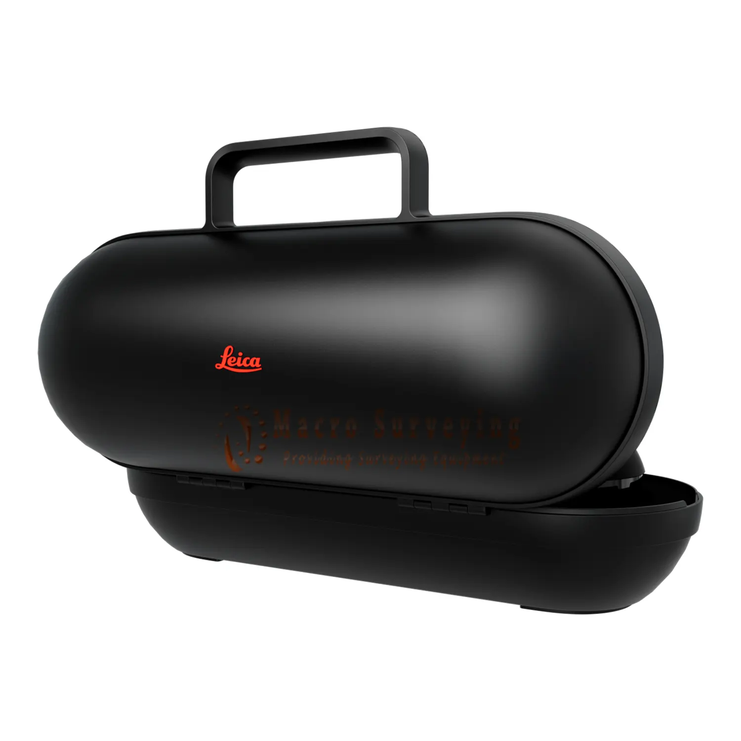
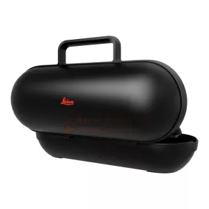
- Leica GVP739 Transportation Case (930175)
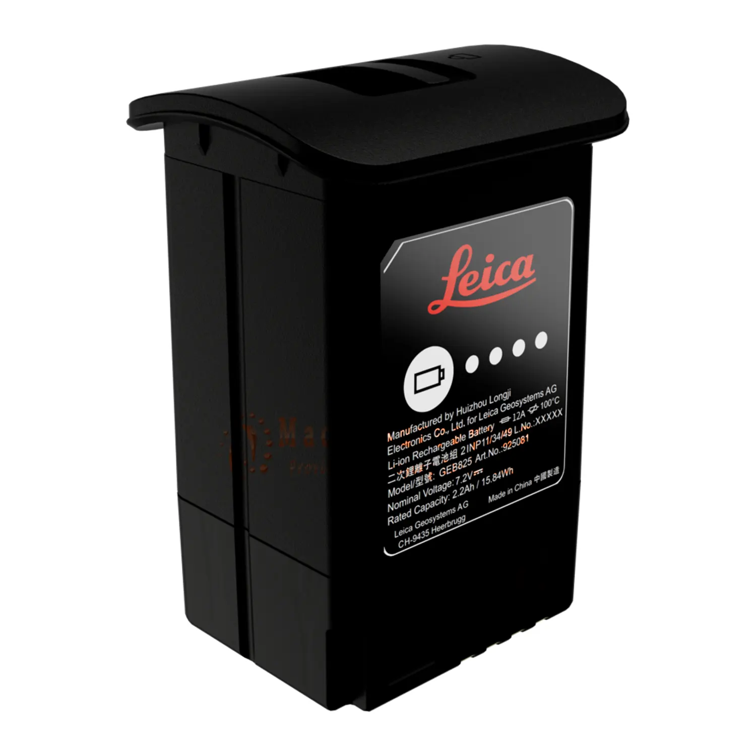
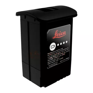
- Leica GEB825 Battery x3 (925081)
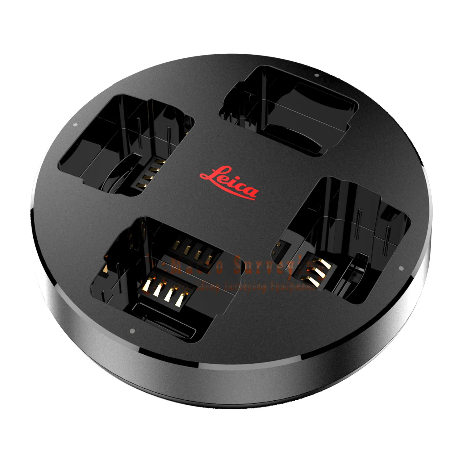
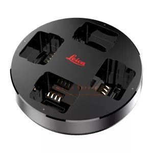
- Leica GKL825 Multi-charger (919898)
- Leica GEV278 USB Cable (879634)
- Leica BLK Cleaning Cloth (939182)
- Leica BLK360 G2 Quick Guide (956370)
- Leica BLK360 G2 USB Documentation Card (954446)
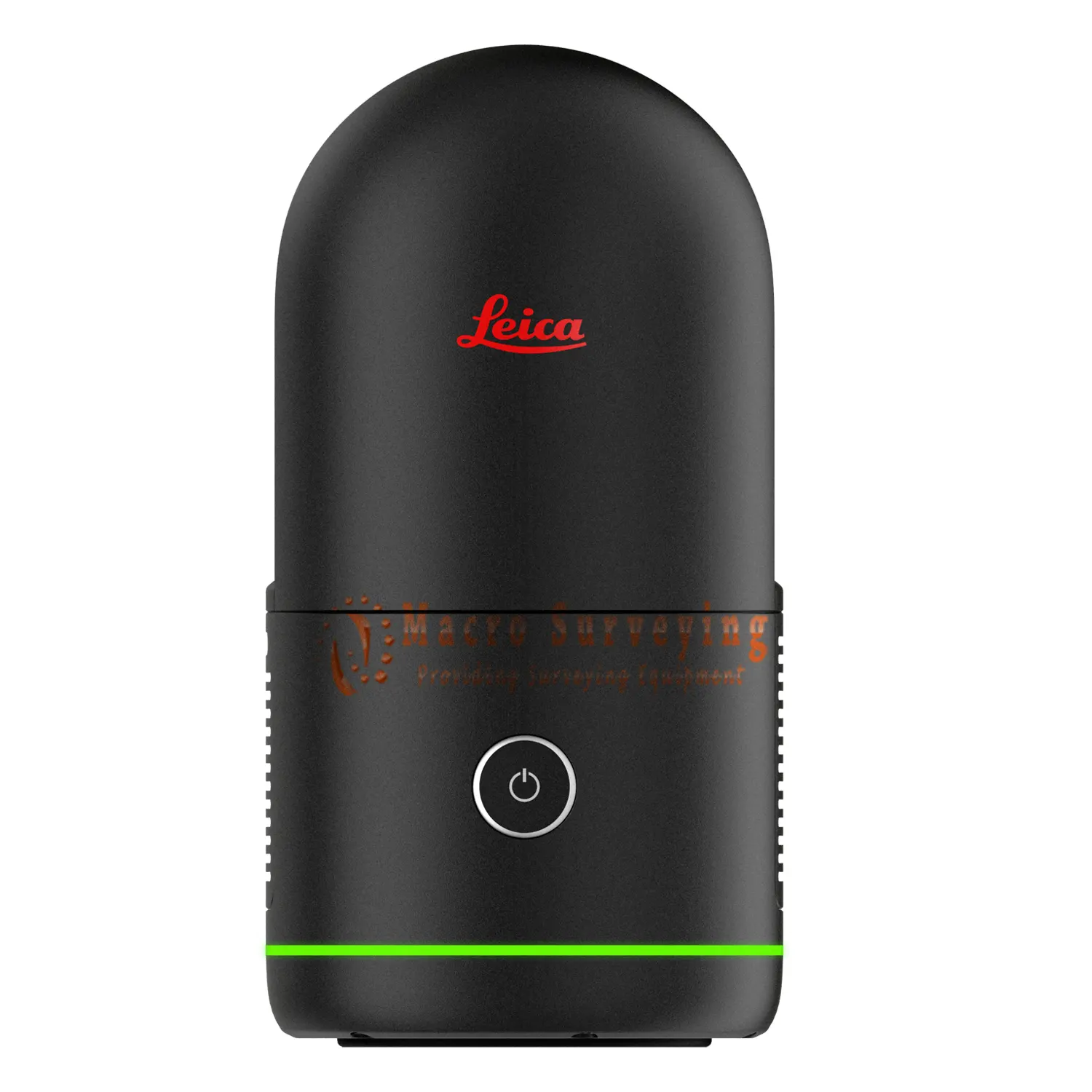
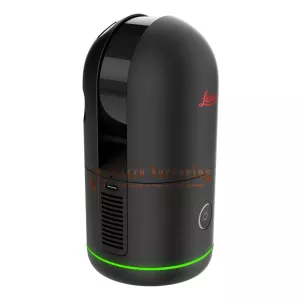
The all-new Leica BLK360 is an advanced precision imaging laser scanner. At the push of a button, users can capture a full scan with spherical images in only twenty seconds - over five times faster than the BLK360 G1. Blaze through job sites with best-in-class rapid scanning that doesn’t compromise on quality, while the Visual Inertial System (VIS) Technology automatically combines your scans on-site to speed up your workflow and help you make sure your datasets are complete. The BLK360 enables users to work faster and smarter while getting the data they need immediately.
BLK360 data is valuable for many uses, from traditional AEC to mind-bending VFX and VR, and users can easily transfer and work with it in your software ecosystem to create immersive and highly accurate deliverables and experiences.
Key features:
- Four scan settings capture data in 7, 13, 30, or 75 seconds at 680,000 points per second
- Rich High-Dynamic Range (HDR) imagery with 5 bracket HDR
- Small and light, measuring 155x80mm and weighing just 850g with batteries
- Five times faster than the BLK360 G1, taking 20 seconds for a full-dome scan with photospheres
- Visual Inertial System (VIS) automatically pre-registers scans in the field
- High-speed data transfer via USB-C and Wi-Fi
Users can control the imaging laser scanner with the Leica Cyclone FIELD 360 mobile-device app and easily pre-register captured scans enabled by the VIS technology. Image and point cloud data is streamed to a smartphone or tablet or final project data to Leica Cyclone REGISTER 360 PLUS or Cyclone REGISTER 360 PLUS (BLK Edition) via Wi-Fi, with full data synchronisation between devices. With automated workflows in both software offerings, the new BLK360 dramatically streamlines the reality capture process. Simple export of LGS, RCP, or E57 files makes working with point cloud data downstream simple and efficient, allowing users to spend less time processing data and more time creating meaningful deliverables.
The BLK360 also includes a free companion app, BLK Live, allowing the user to control the imaging laser scanner and immediately view captured data for on-site feedback, quality assurance, quality control, and export E57 files. Available for iOS and Android.
The new BLK360 also makes it easy to get your data into your preferred software and to share your scans with others. Directly upload your data to Reality Cloud Studio, powered by HxDR with cloud-based visualisation, collaboration and processing, allowing others to work with and download your data. Or transfer your data to Cyclone REGISTER 360 PLUS or export to E57 via USB-C or WLAN for Scan-to-BIM workflows.
Immersive HDR Imaging: The BLK360’s four 13-megapixel cameras capture high-quality photospheres, and 5-bracket HDR imaging captures all the details in challenging lighting conditions and environments for more immersive photospheres and colourised point clouds.
VIS Scan Alignment System: Leica Geosystems patented VIS, available with our Leica RTC360 3D laser scanner, is now built into the new BLK360 to combine scans automatically. Each scan captured in the field combines with the previous scan so you’ll spend less time aligning data in the office and more time creating valuable deliverables.
Ultra-Fast Scanning: The enclosed LiDAR sensor in the new BLK360 captures point clouds at a rate of 680,000 points per second and completes a scan with spherical images in 20 seconds, with flexible scan settings to ensure you capture everything you want and need.
High-Speed Data Transfer: The USB-C port on the BLK360 gives you a faster, easier way to transfer your data, nine times faster than the BLK360 G1. You’ll benefit from fast and stable data transfers without relying on WLAN.
Upload to Reality Cloud Studio: The BLK360, like the BLK2GO, BLK2FLY, and BLK ARC, works directly with Reality Cloud Studio, Hexagon’s easy-to-use reality capture cloud software solution to seamlessly connect people, projects, and reality capture data. Unleash the potential of your reality capture data and foster collaboration by sharing, visualising, and using digital reality data directly in the cloud.
Download the App!: The Cyclone FIELD 360 mobile-device app is free to download. A valid Cyclone REGISTER, Cyclone REGISTER 360 or Cyclone REGISTER 360 (BLK Edition) licence is required to activate Cyclone FIELD 360 as the login credentials are the same. Download the Cyclone FIELD 360 app from the App Store and Google Play.